 |
 |
 Nature
|
 History History
|
Perth and Fremantle
 Central Perth |
 Fremantle |
 Southern Western Australia |
 Coastal Route to Northern Territory |
| revised March 2017 | |
Tourist information
Western Australian Tourist Centre, 55 William Street; t 08 9483 1111; 1300 361 351. Another excellent source for information on Western Australia's national parks and natural wonders is the website of Western Australia Parks and Wildlife (Holiday Pass for all parks for 4 weeks, $46, Annual All Parks Pass $93). A site for the disabled tourist gives excellent information for us all at Access WA.
Airport and Public
Transportation
Perth has an international airport 20km east of the city,
and a domestic terminal a few kilometres closer. Public
buses run regularly to and from the city. Check
with your airline to find the proper terminal, but Qantas
domestic service is mostly from T4 (Bus 40 from Elizabeth
Quay) and all international flights are from T1 (Bus 380
from Elizabeth Quay or Victoria Park). Shuttle buses
between the terminals depart three times an hour.
There is a taxi service to and from town, but as it takes 30
minutes to get into town it is much more expensive than by
bus.
The Western Australian train service schedule appears at Transwa, t
08 9326 2600 business hours.
Local bus and train service for Perth and Fremantle: Transperth, t
13 62 13, 08 9428 1966.
Natural history
The state of Western
Australia is aptly named as it includes the entire western
section of Australia, 2,525,500 sq km, or 32.87 per cent
of the total area of the continent. Its co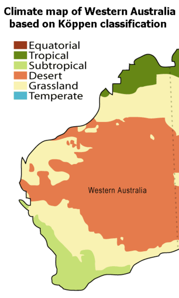 ast line
stretches 12,500km along the Indian Ocean and north into
the Timor Sea. Its capital is Perth, situated in the
southwest. Perth's population of 1,262,600 comprises 73
per cent of the state's total. The major ports are
Fremantle, Albany, Bunbury and Geraldton. The principal
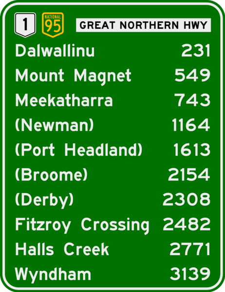
highway is Route 1, a variously named highway which
stretches along the coast from the South Australian border
to the Northern Territory, except for an inland section
from Broome which bypasses the Kimberley region. Other
interior routes include no. 94, which departs north from
Esperance in the south to Coolgardie, then east to Perth;
and no. 95, which traverses an inland route north from
Perth to about Port Hedland, nearly 1400km away.
ast line
stretches 12,500km along the Indian Ocean and north into
the Timor Sea. Its capital is Perth, situated in the
southwest. Perth's population of 1,262,600 comprises 73
per cent of the state's total. The major ports are
Fremantle, Albany, Bunbury and Geraldton. The principal
highway is Route 1, a variously named highway which
stretches along the coast from the South Australian border
to the Northern Territory, except for an inland section
from Broome which bypasses the Kimberley region. Other
interior routes include no. 94, which departs north from
Esperance in the south to Coolgardie, then east to Perth;
and no. 95, which traverses an inland route north from
Perth to about Port Hedland, nearly 1400km away.
The Great Western Plateau covers most of Western
Australia, the Northern Territory, northwest South
Australia and the Mount Isa district of Queensland.
Western Australia is largely a uniformly flat plateau with
shallow valleys becoming deeper as they approach the
coast. The plateau is comprised of granite and gneiss in
the south and sandstone in the north. The Darling Range,
visible to the east of Perth and running north and south,
is in fact an escarpment marking the western edge of the
plateau. The area to the east of the range is known to be
among the oldest geological formations in the world,
having been formed in the Archaean era and remaining
stable for about half of its existence. Exceptions to
these ancient formations are the Mesozoic and upper
Paleozoic areas along the coast and the eastern sections
of the Great Sandy and Gibson Deserts. The occasional low
granite and gabbro outcrops on the Nullarbor Plain are
1500 million years old.
The Nullarbor is an arid, largely uninhabited plateau
lying in South Australia and Western Australia; the name
comes from the Latin for 'no trees'. The plain's limestone
was deposited during a massive subsidence during the
Cretaceous period which also saw much of Victoria and
South Australia submerged. The Great Australian Bight,
sheer cliffs which fall up to 90m to the southern ocean,
forms the plain's southern edge. The plain is crossed by
the Eyre Highway near the coast (Eucla is the only
settlement along the route) and by the Indian-Pacific
railway. Remarkably, one section of this famous railway
line is straight for 479km.
People speaking the Nyungar languages lived in the area
from the Nullarbor to the Western Australian coast as far
north as Geraldton and inland as far as Kalgoorlie-Boulder
and Mount Magnet. Groups living in the cooler, wetter
regions in the southwest built temporary weather-proof
thatched huts. Those living inland practised male
initiation rites similar to the neighbouring desert
people, indicating some social relation with these groups.
The first massacre of Aboriginal people in Western
Australia occurred south of Perth on the Murray River at
Pinjarra in October 1834, five years after settlement. At
the prompting of settler James Peel, Governor James
Stirling sent five mounted police to attack the Aboriginal
settlement. One of about ten punitive raids during the
decade, this one broke the tribe of the local leader,
Calyute, and resulted in an accord.
North of the Nullarbor, the Great Victorian, Gibson and
Great Sandy Deserts form the state's inaccessible eastern
regions. To their west are the goldfields which seem to
crop up here and there through virtually the entire north
and western area of the state.
The state's population and major agricultural areas form a
triangle on the southwest. Here winter rainfall exceeds
25mm inland and increases as you approach the coast. Perth
receives nearly as much rain as Sydney or Brisbane, though
this falls generally in the winter months.
Above the Hamersley, the Great Sandy Desert
nearly reaches the Indian Ocean in Western Australia's
far northern corner between Port Hedland and Broome.
The
Kimberley region makes up the far north, east of
Broome. It receives summer (December to February)
monsoonal rains, but is dry during winter. The
predominant flora is scattered eucalypt of low to
medium height above hummock grass. Along the coast is
an intertidal mixture of mangrove, shrubs and mud
flats. In river deltas these features can be
extensive. The area is noted for spectacular gorges at
Fitzroy Crossing and Wandjina figures in the
Aboriginal rock art near Kununurra.
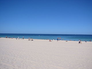
Flora and fauna
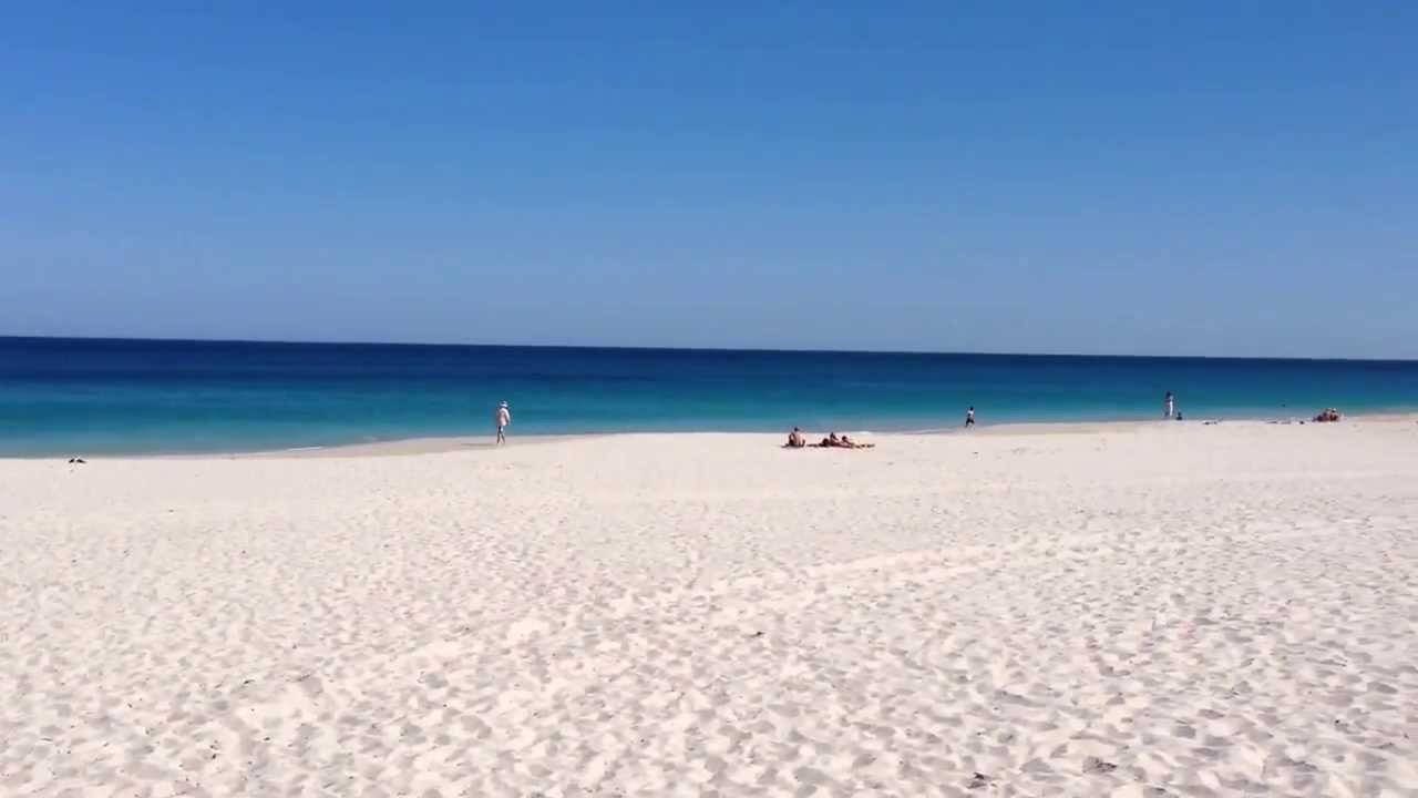
Travellers
routinely praise the colours in the Perth and
Fremantle area. The beaches here have brilliant white
sand of calcareous limestone and the ocean is, indeed,
India Blue. Locals point out that Leighton and Port
Beaches have patches of emerald-coloured water
offshore.
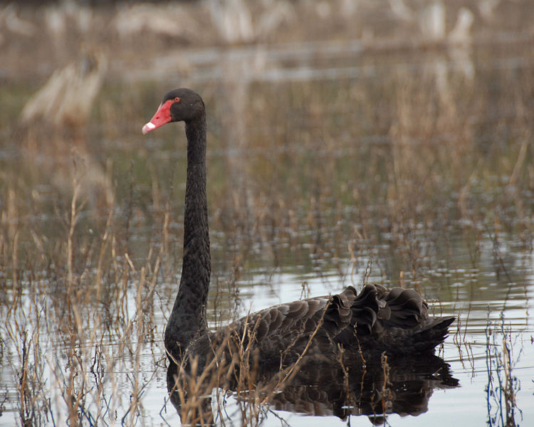
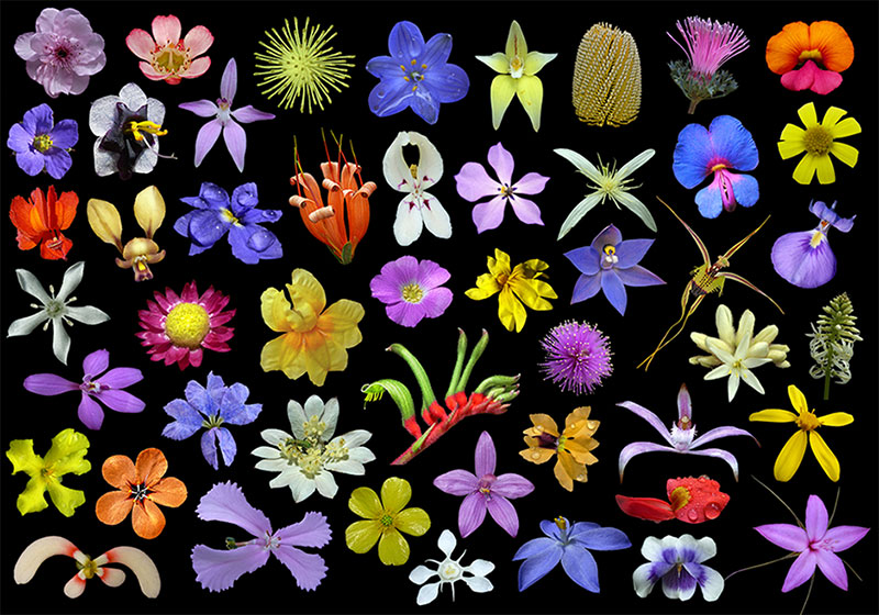
The bird populations of Western Australia
include similarly familiar species, but novel sightings
can be logged of the smaller rock and elegant parrots,
various honeyeaters, ringnecks and gerygones (a small
warbler). Miraculously, the vile introduced species of
starlings and mynas of the east coast are absent here,
as are sparrows. The state takes considerable care to
keep these agricultural and aesthetic vermin out. Mammal
species include the echidna, local species of wallaroo,
kangaroo and possums, but no platypus, wombat or koala.
Carl Hügel

Perth 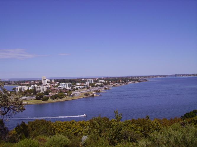
Visitors to Perth (population 1,262,600) remark on its stunning geographical beauty, with the lookout from Mount Eliza across the Swan River a required stop on any tour. Mount Eliza is in the part of the city called Kings Park, thankfully gazetted as parkland as early as 1831 and still one of the most attractive urban parks in Australia. From the 1840s, British residents in India travelled to Western Australia to enjoy the Mediterranean climate, the most temperate and consistent of all Australian cities.
The most notable
factor determining the development, history, and social
conditions of Perth has been its vast distance from
anywhere else, most significantly its remove from the
rest of developed Australia. Indeed, being 2700km from
Adelaide, the city can still be described as the most
isolated Western capital in the world. Telegraph
communication with the eastern states was established
only in the 1870s, and the famous Trans-Australian
Railway, now the Indian-Pacific Line, across the
enormous and desolate Nullarbor Plain, was not completed
until 1917. Perth is substantially closer to Indonesia
than to Sydney or Melbourne; recently, with regular
airline connections, many Indonesians actually commute
between the city and Jakarta.
Still, Perth is distinctly Australian in its attitudes
and lifestyle, revelling in its independence and
isolation from the 'Eastern States', as Western
Australians consider the rest of the country. (In turn,
other Australians refer to Western Australians as
'sandgropers'.) During the Depression of the 1930s, a
strong secessionist movement developed, prompted by the
belief that Western Australia could do better on its own
than as a state in the Australian Commonwealth.
A booming economy in the 1980s led to Perth's 'discovery' by outsiders, both Australian and international, resulting in population growth and greater communication with the rest of the world--a situation not always welcomed by old-timers. Perth was the base from which such well-known entrepreneurs as Alan Bond, Laurie Connell and Christopher Skase amassed their fortunes in this greedy decade, only to see their paper empires plummet amidst lawsuits, bankruptcy and criminal charges in the more sober atmosphere of the 1990s.
Today, the city is
both vibrant and laid-back, with high-rise buildings
everywhere, along with the sometimes overwhelming
mansions of the nouveau riche, but still nurturing its
love of the sun and enjoying its magnificent ocean. The
city hosts, in early January, the prestigious Hopman Cup which
precedes the Australian Open Tennis competition in
Melbourne. It pits national teams against each
other rather than individuals. The Perth
International Arts Festival, the oldest
international arts festival in the Southern hemisphere,
is held here in February and March every year. The
schedule actually encompasses about half the year.
In addition to its incredibly diverse offerings related
to visual arts, writing and music, it has recently begun
an ambitious international film series. Perth's
three-day International
Jazz Festival in November offers free and ticketed
events. The organisers look to present both young
and established musicians.
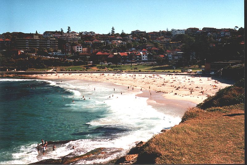
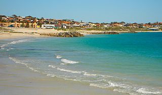
Perth beaches
Perth is justly proud of its many city beaches, acclaimed
as the best in Australia (and this is a very large claim
indeed). Most of them have stunning white sands and bright
blue waters, and most are accessible by bus or train (check
with Transperth,
t 13 62 13). Some beaches that any visitor should see
include:
 |
 |
| Cottlesloe:
11km southwest of Perth's city centre, this is the trendiest place to go to 'see and be seen'. Only 4km north of Fremantle, easily accessible from the Fremantle train. |
City Beach:
the quintessential city beach, broad and spacious, home of the Perth Surf Club. About 10km west of the city centre, with a bus service. |
 |
 |
| Sorrento Beach:
19km northwest of town, this is the family beach par excellence, the location of Hillarys Boat Harbour, Sorrento Quay, and -- of most interest to children -- Underwater World (t 08 9447 7500; open daily 10.00-17.00, admission: adults $30, concession $22, children $18), a 'hands-on' aquarium, with a tunnel to view sharks and manta rays, and a touching pool with dolphins. |
Scarborough
Beach: 14km northwest of central Perth, this is probably the best known of Perth beaches, a continuation of the city's coastal run of surf and sand; some very nice ocean view hotels and holiday units are located here. |
 |
|
| Leighton
Beach, Fremantle: very close to the railway terminal, a world-famous surfing spot, but also good for swimming. excellent coffee and desserts. |
History
Perth is set at the base of Mount Eliza on the banks of the Swan River. Named after the Scottish birthplace of then Secretary of State George Murray, the city is built on a grid plan following the work of Surveyor General John Septimus Roe in 1829. The area of present-day Perth was first sighted by the Dutch under Willem de Vlamingh in 1696, who mapped and named the Swan River, after the black swans he saw there. The first instance of European interest in the western edge of the continent was a suggestion by Jean Pieter Purry in 1718 that the Dutch East India Company form a settlement in its southwest section; this suggestion was never taken up, as explorers could find no obvious trade resources in this apparently barren land. In 1801, the French under Nicolas Baudin also explored the area, but considered it unsuitable for anchorage or settlement.In 1826, Lord Bathurst in London instructed Governor Darling, then in Sydney, to survey Shark Bay on the far northwest in case the French were interested in the area. Bathurst immediately changed his mind, instructing Darling to settle convicts at King George Sound on the southern tip of the state. Envisioned as a strategic outpost in line with shipping from England to Port Jackson, this settlement was near present-day Albany. Founded in 1826, it lasted only two years before the personnel were transferred to Swan River, where efforts to establish a settlement had just begun.
The founding of Perth and Fremantle was due to the insistence of James Stirling, who led the first British expedition to the Swan River in 1827. About this area he wrote: 'We sailed through a rich and romantic country...the bright foliage of the shrubs, the majesty of the surrounding trees, the abrupt and red-coloured banks of the river occasionally seen, and the view of the blue summits of the mountains, from which we were not far distant, made the scenery around the spot as beautiful as anything of the kind I have ever witnessed.' His glowing descriptions of the area and his audacious request to become the settlement's first governor fell on deaf ears. John Barrow, the Secretary of the Admiralty, described Stirling's expedition as quixotic and contradicted his account of the entrance to the Swan River and adjacent country upstream.
Depending instead upon his father-in-law's connections, Stirling sought a combination of private capital and a grant of Crown Land to found the colony. The first attempt to accomplish this venture involved Thomas Peel (1793-1865), the second son of prominent cotton manufacturer Robert Peel, and a few opportunistic investors. They asked for four million acres and first choice of land. The government's counter offer of one million acres and fair apportionment of land resulted in the venture being withdrawn.
Renewed fears of French interest in the area and the flurry of applications from prospective settlers convinced the Colonial Office to proceed with a land grant approach to settlement. The terms required minimal expense for the civil and military presence: that 40 acres be given for each £3 invested and that the holdings be improved within ten years of occupation. The Challenger, which carried the civil authorities, and the Sulphur (some authorities report this ship to have been the Parmelia), which carried the military personnel, entered the Swan River on 1 June 1829. The first private settlers arrived in August on the Calista. The captain of the Challenger, Charles Fremantle, was the first to use the word 'Australia' officially when he formally claimed Western Australia for Britain.
Financially, Stirling and Peel looked to emancipist merchant banker Solomon Levey (1794-1833) in Sydney to provide the money in a partnership kept secret to avoid the taint of his being Jewish and a transported convict. Levey's contemporaries attributed his death shortly thereafter to the fiscally ruinous situation at Swan River.
From the first day, when Stirling's enthusiastic attempt to take a short cut through the shoals at the mouth of the Swan River caused the Parmelia to run aground, conditions for the settlers were grave. The land was sandy and dry except where it was thick with trees or boggy. While Stirling maintained a sense of gentility, Thomas Peel became increasingly bizarre: taking a shot in the arm in a duel with the captain of the ship carrying settlers for his acreage south of Fremantle, issuing promissory notes which were not honoured to workers he sued for passage money when they insisted they be paid, and riding about his property ill dressed.
By the time Stirling left the colony in 1839, it was only nominally productive and still imported all of its wheat and flour from Hobart. In 1846 some colonists petitioned for help in the form of convicts to work. To the consternation of the Victorian Anti-Transportation League, the first lot of transportees (75 felons and 54 guards) were sent in 1850. By 1868, nearly 10,000 men had been transported to Western Australia, most of them after transportation had been abandoned in the other colonies. In The Fatal Shore, Robert Hughes maintains that the population growth and prosperity of South Australia, Victoria, New South Wales and Queensland contrasts with the lagging economies of Western Australia and Tasmania because the latter were 'stuck for decades in their hangover from the malign indulgence of semi-slave labor'. Only the discovery of gold in the Kimberley region (1885) and particularly in Kalgoorlie (1893) brought both money and a sharp increase in population to Perth.
Selecting a site for the colonial capital followed straightforward 19c principles. Fremantle, 19km south of Perth, would serve as the port, but the capital had to have secure defences against foreign attack. Point Heathcote (now Applecross), near Fremantle on the south shore of the Swan, or Point Frazer would also have suited as a settlement site. While Point Heathcote had a slightly better anchorage and much better cooling sea breezes, the Perth location was more picturesque and had access to the agricultural land held by Stirling, Roe and other colonial stalwarts.
Roe is reported to have modelled the town after the 'New Town' section of Edinburgh. The town plan described a three-square-mile rectangular
arrangement
between the Swan to the south and east, Mount Eliza to the
west and some swamps to the north. Streets ran parallel to the
Swan beginning with St George's Terrace, Hay Street (its
slight elevation made it the most important thoroughfare),
Murray Street (after Hay's superior, Colonial Secretary John
Murray) and Wellington Street. Sadly, no effort was taken to
convert the swamps into a garden district. Worse, Roe sold the
reserve land between the Swan and St George Terrace and behind
the barracks. Although Stirling repurchased the Government
House site, the opportunity for a strong area for governmental
buildings was lost.Development of Perth and the rest of the state proceeded slowly; by 1858, the population of Perth was 3000, and when it was incorporated as a city in 1871, only 5000 citizens had settled here. The gold rushes in Kalgoorlie and elsewhere at the end of the century brought thousands of immigrants, and by the time of Federation in 1901, the metropolitan area, including Fremantle, had increased in population to 44,000.
As well as building mines and bridges and dredging channels for shipping and transport, convict labour between 1850 and 1868 erected a number of public works. They built or improved roads between Fremantle and Perth, east to York, and to Bunbury and Albany to the south. They erected public buildings including Government House, the Town Hall, Perth Gaol, Pensioner Barracks and Causeway. In Fremantle, the equivalent convict-built structures are the Fremantle Gaol and Convict Asylum. The latter is now the site of the Fremantle Arts Centre.
Initially, the area around Barrack Street and St George's Terrace were devoted to administrative, business and upper-class residences; Hay Street contained commercial and shopping venues; and the area to the north around Wellington Street became artisans' workshops and cottages. The elite families built their residences at the west end of St George's Terrace, particularly above where it becomes Mount Street and rises to catch the sea breezes. Australian novelist and teacher J.K. Ewers described the architecture of the older residential areas in Money Street (1938): 'The houses were closely packed with ornate frontal decorations that were relics of the late-Victorian age of cottage architecture. Here was a wreath of flowers, species unknown, set in masonry. There, a pillared balustrade hid a receding gable. Quaint houses they were, each breathing a definite personality.'
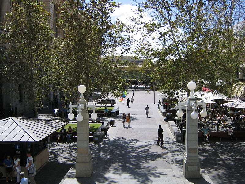
Central Perth
Central Perth forms an elongated rectangle at Perth Water on the Swan River. Although oriented on a west-northwest to east-southeast grid, for simplicity, the directions given in the walk below assume that Perth Water is directly south rather than south and a bit west. The highway into the city crosses the Causeway at Heirisson Island. The major streets from south to north are Riverside Drive, Adelaide Terrace, which becomes St George's Terrace, Hay (originally Howick), Murray and Wellington Streets. The Perth Railway Station is on Wellington Street. The major cross streets are Plain, Victoria Avenue, Barrack and William Streets. Adelaide/St George's Terrace is the principal road; it leads past the larger hotels, Government House and St George's Cathedral, then over the Mitchell Freeway at Malcolm Street to enter Kings Park Botanic Gardens. The highway leading to the University of Western Australia, some older suburbs and Fremantle skirts Kings Park on the Swan River side of William or Barrack Streets.
A walk around the city centre

This walk follows a route through the city centre in a clockwise direction from the General Post Office to Victoria Square, through the Stirling Gardens on the river, into the centre again and west, returning to end at the Hay Street Mall. The Western Australian Museum and the Art Gallery of Western Australia are situated immediately north of the Perth Railway Station via Beaufort Street. The station was built in 1891-94 following a design by G.T. Poole. The flanking bays were added in 1897 to cope with the gold rush traffic. The area immediately in front of the station was used as a plaza for election campaign rallies until recently. The mechanical signal box near the station still functions to control railway traffic. Note the ornate arcade and swans -- Western Australia's conspicuous emblematic bird -- which decorate the lamp posts on the Horseshoe Bridge to the west of the station.
The General Post Office (1930s) on Forrest Place across Wellington from the railway station has a classical façade and colonnade faced with Mahogany Creek granite and Donnybrook stone. The framework is, in fact, steel encased in concrete. This tendency to construct modern buildings in a style reminiscent of the 19C is also seen in the Commonwealth Bank immediately south of the GPO on the northwest corner of Forrest Place and Murray Street. The bank, built in 1930-33, consciously matches the design of the GPO, with cornice lines, pilasters and giant columns. Initially, a second structure nearly identical to the bank was to have been built north of the GPO to further accentuate the symmetry, but the Depression brought an end to such ambitious construction.
Walking east on Murray Street leads past a bookshop at no. 196. William Wolf designed the exuberant bay windows and inset balcony as a hotel in 1924.
The former Government Printing Office is at the corner of Murray and Pier Streets. Designed by G.T. Poole and built on the site of the Poor House in 1879, the building includes additions made in the early 1890s which are readily identified as the mismatched upper floors and as an extension at the building's northern end.
The Fire Brigade Historical Society runs the City Number 1 Fire Station (t 08 9323 9468) on the corner of Murray and Irwin Streets, across from a well-known Moreton Bay Fig, listed on the National Registry of Trees. A turn-of-the-century brick and rusticated limestone structure, the fire station functions as a museum of firefighting, now called officially the Fire Safety Education Centre and Museum (open weekdays 10.00-15.00).
Another of Poole's designs is again on the north side of Murray Street just past Irwin Street. Now the Administration Building of the Royal Hospital, its Romanesque style derives from the hatchwork on the balconies. At the end of Murray Street is Victoria Square, which dates from plans in 1833 to establish the site as Church Square. When the Church of England decided to build nearer Barrack Street, the Roman Catholic Church was given the land. St Mary's Cathedral, on the south side of the square, was built by Benedictine Brothers under the second Roman Catholic Bishop Martin Griver beginning in 1863. These monks built the original Bishop's Palace in 1859 and churches in Fremantle and Guildford as well. Their dawn-to-dusk working hours and daily trudge from their hospice in the suburb of Subiaco are frequently recounted. The Gothic Revival design was drawn by noted English ecclesiastical architect Augustus Pugin shortly before his death in 1852. Considerable remodelling and additions make it difficult to discern the original lines of the church.
Children of Mary Chapel and Sisters of Mercy Convent are south of the square on Victoria Avenue to Hay Street. The original buildings are simple cement-rendered brick structures built during the 1840s. The two-storey building on the east side of the convent was completed in 1849 and features triple Gothic windows and fanlights over some doorways. The Mother House of the Convent was built in 1873 based on plans drawn by an Irish political prisoner named McMahon. Its construction is of chequered brickwork, timbered verandahs with cast-iron lace work and three steep gables.
From Victoria Square, walk one block south to Hay Street again. One block east at Hill Street is the Perth Mint (t 08 9421 7223; open weekdays 09.00-17.00, admission adults $19, concession $17, children $8, families $48), open to the public daily to view gold melting and the production of bullion. It also includes some historical displays about refining and mining processes.
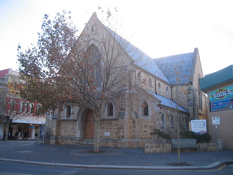
If you continue east on Hay Street, then north on Plain Street c 1km, you will come to the East Perth Cemeteries. These seven cemeteries date from the colonial period, the first burial having taken place in 1830. Its grounds are divided by denomination. St Bartholomew's Chapel in the cemetery was built in 1871. Some of the city's earliest settlers are buried here. The last internment was in 1899. Return to Pier Street to reach St George's Cathedral and its Deanery. The first St George's Church was erected between 1841 and 1845 and was a stolid, unimaginative design.
Richard Roach Jewell
Richard Roach Jewell (1810-91) was born in Devon, England, and apprenticed there as an architect and builder. For the sake of his wife's delicate health, he migrated to Western Australia in 1852. Here he worked briefly in the Convict Settlement, transferred as foreman to the Department of Public Works in Perth, and was appointed superintendent by Governor Fitzgerald. Initially, his talent for controlling expenditure served him well, his early projects being largely to repair roads and bridges and construct the Perth and Fremantle Boys' Schools. Once the impact of convict labour freed some funds for more ambitious projects, he built the Perth Town Hall, Wesley Church, Public Trust Office, Treasury and Cloisters as well as a number of buildings in surrounding towns.
The current cathedral was designed by famous Sydney architect Edmund Blacket as an architectural reference to 13C gothicism (successful except for the blockish tower erected in 1902); it was completed in 1882. Notice how your eye is led upward by the shortening stone courses. Another illusionistic device is the miniature bas-relief colonnade with reduced-sized windows which make the building look taller. The interior features a warm rose-coloured brick, vertical windows behind the altar, and jarrah hammerbeams.
The Deanery is immediately to the east on St George's Terrace. An Australian version of English cottage style, it was constructed in 1859 for the colony's first dean, George Pownall. Either Pownall or Richard Roach Jewell, the Colonial Clerk of Works, provided the design. Like other buildings of the time, it features light-coloured bricks. The house, one of few from the period, escaped demolition in the early 1950s when the then Dean John Bell accepted public opinion to save it and even stood the cost of restoration.
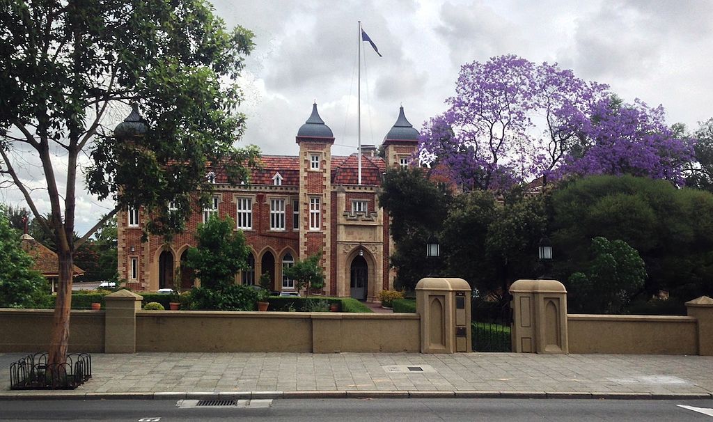 Across St George's
Terrace to the east is Government House. It had a predecessor
which, by the time the current structure was begun in 1859,
was termite-ridden with a leaking roof. Western Australian
Governor Kennedy approved its design, but his successor, John
Stephen Hampton, found it necessary to insist on extensive
revisions, primarily increased room size. Like the other
signatory buildings of Perth-the Town Hall, Cloisters and
Barracks-Government House is a Colonial Gothic design with
Tudor influences. For evidence of the former, note the pointed
arches on the verandah; for the latter see the towers. Also in
common with the buildings of the period, the coloured bricks
are laid in 'Flemish bond' style familiar in Richard Jewell's
buildings. While Jewell supervised the construction, the
design was by E.Y.W. Henderson. Interior features of note
include a jarrah and cast-iron stairway and marble fireplaces.
The ballroom was replaced in 1899 with the current room
designed by J.M. Grainger. As the official tourist brochures
state, 'Government House and its private gardens are 'open to
the public from time to time', indicating that 'open days'
occur occasionally.
Across St George's
Terrace to the east is Government House. It had a predecessor
which, by the time the current structure was begun in 1859,
was termite-ridden with a leaking roof. Western Australian
Governor Kennedy approved its design, but his successor, John
Stephen Hampton, found it necessary to insist on extensive
revisions, primarily increased room size. Like the other
signatory buildings of Perth-the Town Hall, Cloisters and
Barracks-Government House is a Colonial Gothic design with
Tudor influences. For evidence of the former, note the pointed
arches on the verandah; for the latter see the towers. Also in
common with the buildings of the period, the coloured bricks
are laid in 'Flemish bond' style familiar in Richard Jewell's
buildings. While Jewell supervised the construction, the
design was by E.Y.W. Henderson. Interior features of note
include a jarrah and cast-iron stairway and marble fireplaces.
The ballroom was replaced in 1899 with the current room
designed by J.M. Grainger. As the official tourist brochures
state, 'Government House and its private gardens are 'open to
the public from time to time', indicating that 'open days'
occur occasionally.Stirling Gardens, which extend from the corner of Irwin Street and St George's Terrace to Barrack Street, are of some interest. Representing an example of 19C English landscape gardening, they feature 'Royal Trees' planted by each visiting member of the British Royal Family, formal rose beds, and large expanses of lawn. The Norfolk pines were planted in 1867.
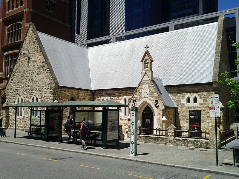
The Old Court House on the southeast corner of Stirling Gardens is a modest building, the oldest in Perth. A primitive colonial structure with stuccoed walls and a later portico, it was designed by Henry Reveley in 1836. He had travelled in Italy and Greece, thus the hint of neo-classicism in the design. It functioned in its early days as a church, boys' school, girls' school and concert hall. As a concert hall, it saw a memorable charity concert in 1846 given by Rosendo Salvado, an impoverished Benedictine monk from Spain who sought support for his order's mission to the Aborigines at New Norcia, north of Perth. The Old Court House now houses the Francis Burt Law Museum (t 08 9324 8686; phone for entry information), which offers guided tours and arranges viewing of court proceedings, and even participation in mock trials.
To the west of the Old Court House is the Supreme Court Building. Situated on what was once the foreshore embankment, the design of this 1906 building reflects the post-gold rush boom years. The Italianate columns are of Donnybrook white stone. J.M. Grainger, father of famous composer Percy Grainger, was the design architect. These structures are surrounded by pleasant gardens that lead to the Swan River. At Barrack Square are the ferries to the zoo, Rottnest Island, and touring cruises.
Across Barrack Street on the northwest corner of the Esplanade is the Weld Club, an award-winning design by J.J. Talbot Hobbs built in 1891-92. The building has especially fine woods in the interior, and is situated in elegant gardens down to the river. The Esplanade Gardens to the south of this row of buildings, leading down to the Swan River, is another pleasant green spot in the city. Walk north on Barrack Street to St George's Terrace to find the Central Government Offices. This group of Classic Revival Victorian public buildings were constructed between 1874 and 1905, and served as the General Post Office until 1923. Facing them on Barrack Street, the section to the left of the arched entrance dates from 1874, that to the right is from 1877. Both were designed by R.R. Jewell. The third story was added in sections between 1896 and 1905. The section linking the two wings was completed by Jewell's successor, G.T. Poole, in 1887 to 1890. The building is an interesting transition between the Gothic Revival and the Italianate styles in that the simpler patterned, coloured brick gives way to projecting pilasters and ornament around the windows and doors. Jewell had arrived in the settlement a mere year before his appointment as Superintendent of Works in 1853; he served for 30 years.
The T
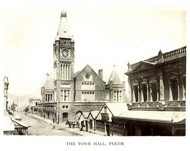 own
Hall, behind the Treasury on the corner of Barrack and Hay
Streets, is also believed to have been built by R.R. Jewell.
This Scottish Tudor-style structure was erected between 1867
and 1870. Its construction was largely carried out by convict
labour and stories recount that the downward pointing
arrow-shaped windows in the tower are their mementoes to the
town, as such designs appeared on convicts' uniforms. The hood
mouldings above the windows are stone-cut hangman's ropes.
Efforts by city councillors in 1924 to demolish the tower were
frustrated, but the Tudor style arches on the ground floor did
succumb to subsequent renovation when the City Council let the
area for commercial use. The city recently razed a hideous
bank building to the Town Hall's south and west, revealing
façades previously hidden.
own
Hall, behind the Treasury on the corner of Barrack and Hay
Streets, is also believed to have been built by R.R. Jewell.
This Scottish Tudor-style structure was erected between 1867
and 1870. Its construction was largely carried out by convict
labour and stories recount that the downward pointing
arrow-shaped windows in the tower are their mementoes to the
town, as such designs appeared on convicts' uniforms. The hood
mouldings above the windows are stone-cut hangman's ropes.
Efforts by city councillors in 1924 to demolish the tower were
frustrated, but the Tudor style arches on the ground floor did
succumb to subsequent renovation when the City Council let the
area for commercial use. The city recently razed a hideous
bank building to the Town Hall's south and west, revealing
façades previously hidden. Trinity Congregational Church is reached by walking west on Hay Street along the Mall, left on Sherwood Court to St George's Terrace, then west again. (Walking through London Court is a short cut.) The original church on the site was designed by Jewell in the mid-1860s. Like much of his so-called 'Colonial Gothic' work, the ornament is created with patterned brickwork. It can be glimpsed through the garden area beside the later church. This later structure dates from 1893, a period of gold rush prosperity which is given full expression in the design by Henry Trigg in its ornate Romanesque windows, turrets and wrought-iron filials.
The Palace Hotel stands on the west side of Trinity Church. This three-storey hotel, now used as a bank, dates from 1895. It was designed by Porter and Thomas and constructed of bricks imported from Melbourne. The timber balconies with cast-iron balustrades are decorative. Internally, the cedar staircase, marble fireplaces and moulded plaster ceiling in the dining room are evidence of the prosperous era of its construction.
Old Perth Boys' School, west on St George's Terrace and on the left past William Street, has a venerable history. Resembling a church, the school was built in 1852 with wings added in the mid-1860s. Unlike other structures of the period, the builders used local materials including sandstone quarried at Rocky Bay near Fremantle. The Gothic design was by William Ayshford Sanford, an amateur architect responsible for Fremantle Boys' School as well. Sanford was colonial secretary at the time and devoted to the Camden Society, a group fostering Elizabethan interests. The School is now leased to Curtin University and has a variety of functions.
Continuing west on St George's Terrace, on the right past King Street is the Cloisters. Actually built as Bishop Hale's Collegiate School, the name refers to the cloistered verandah on its north side. Built in 1858 from R.R. Jewell's design, the Tudor-influenced Colonial Gothic style is immediately recognisable. Again, Flemish bond chequered brickwork provides the ornament; that on the east side of the building is particularly pleasant. Hale intended the school to be an alternative to education in England, but it closed for want of pupils in 1872. Subsequently used as a girls' school, a seminary and a dormitory, it currently houses professional offices and businesses.
The west end of St George's Terrace was once occupied by the Barracks. Along with the Cloisters and the Town Hall, the Barracks have been strongly associated with the history of the city. Sadly, this wonderful brick structure has been reduced to just the entry arch. Its function may not have reflected favourably on the colony, housing the guards and their families who stood over the impressed convict labour of the late 19C. Like the convicts, the guard, called Enrolled Pensioner Forces, seem to have been readily forgotten.
Continue north one block on King Street, past His Majesty's Theatre (short daily tours conducted by the Theatre's Friends group, 10.00-16.00; admission $2; more serious group tours are also available, phone 08 9265 0900 mid-week to make arrangements), on the corner of Hay and King Streets. Designed by A. Wolffe and built in 1904, the theatre was the first steel and concrete building in Australia and is billed as Australia's only remaining Edwardian theatre. Locally known as 'the Maj', the theatre is still the city's most important venue for theatre, opera, ballet and musicals.
To the east on Hay Street at its juncture with William Street is Wesley Church. Having opened in 1870, the church served a Methodist congregation which had been active since the colony's founding. In fact, about 50 of the earliest farmers and their families were Methodists brought en masse to the colony aboard the Tranby, chartered by the Hardey and Clarkson families of Yorkshire and Lincolnshire in 1830. Methodism grew rapidly during the gold rush boom of the 1890s. The design will be recognised as another of Jewell's many creations.
Perth's museums
The Western Australia Cultural Centre (t 08 9492 6600) is directly behind the railway station from the city, accessible via Barrack Street. It incorporates the Art Gallery of Western Australia (t 08 9492 6622, open daily 10.00-17.00, closed Tuesdays) on Roe Street, the Western Australian Museum (t 08 6552 7800; closed until 2020 while the New Museum is being built) and the State Library (t 08 9427 3111; open Mon.-Thurs. 9.00-20.00, Fri. 9.00-17.30, Sat. and Sun. 10-17.30, closed holidays) on Francis Street between Beaufort Street (Barrack Street to the south) and William Street.
The Art Gallery of Western Australia is a modern construction (1979) by Charles Sierakowski. Its collection is eclectic, preferring Australian and contemporary Asian topics. Particularly well represented are works by Robert Juniper (b. 1929), a well-known Perth artist who paints, according to art historian Terry Smith, 'in delicate, sun-drenched colour and in large, decorative forms, his deep affection for the burnt hills of his native country'. The gallery's collection includes one of the finest exhibitions of Aboriginal art in Australia.
The Library and Museum were originally in the Victoria Jubilee Building (the library was in the basement, the mammals on the first floor and the birds on the second floor). Although the cornerstone was laid in June 1887, building work was not begun until 1897. Its design was by G.T. Poole's successor as Colonial Architect, J.M. Grainger, Percy Grainger's father. A 'Victorian Byzantine' style structure, its arches and columns are of Rottnest Island sandstone and its foundations and basement are of Cottesloe Sandstone.
 The Gaol housed the
state's art collection for many years before the current
gallery building was constructed. R.R. Jewell designed this
utilitarian structure which functioned as a gaol and court in
1853. Used for female prisoners, debtors and those awaiting
trial, it was only briefly used as a prison before that
function was transferred to the Fremantle Gaol. The stone for
the building was quarried at Rocky Bay near the mouth of the
Swan River and transported by barge to the site. The most
handsome elevation is from Beaufort Street, and the design for
the entrance can be found in the Royal Engineers' pattern
book. In 1895 the gaol's function changed to that of a
historical museum. In the 1970s the building was renovated.
While it could not be restored to its original form, ceiling
heights were returned to those specified by Jewell.
The Gaol housed the
state's art collection for many years before the current
gallery building was constructed. R.R. Jewell designed this
utilitarian structure which functioned as a gaol and court in
1853. Used for female prisoners, debtors and those awaiting
trial, it was only briefly used as a prison before that
function was transferred to the Fremantle Gaol. The stone for
the building was quarried at Rocky Bay near the mouth of the
Swan River and transported by barge to the site. The most
handsome elevation is from Beaufort Street, and the design for
the entrance can be found in the Royal Engineers' pattern
book. In 1895 the gaol's function changed to that of a
historical museum. In the 1970s the building was renovated.
While it could not be restored to its original form, ceiling
heights were returned to those specified by Jewell. When nearing retirement, Colonial Architect G.T. Poole was commissioned to design the Beaufort Street Building to house the art collection. Although the 1896-97 exterior is far from Poole's best, the Hellenic Gallery's interior features jarrah floors and remarkably good interior light. The library was eventually housed in Hackett Hall, built in 1920 and named after John Hackett of the West Australian newspaper. When it outgrew the space, it was housed on the northwest corner of the centre, freeing Hackett Hall for special exhibits. Throughout this tumult, the Old Gaol remained devoted to the social history of the region.
In addition to this central complex, the museum is also responsible for the Maritime Museum and Boat Shed, and regional museums for Albany, the gold fields, and Geraldton.
West Perth
St George's Terrace at this end turns into Malcolm Street and then becomes Kings Park Road, running along the edge of Kings Park itself. This section of town is called West Perth; from St George's Terrace, take the Purple Clipper train to reach the area.
Just west of the Mitchell Freeway on Harvest Terrace is Parliament House (t 08 9222 7222; open weekdays 09.00-17.00 when in session, returning Feb. 2017), which offers tours. On Havelock Street, one block west of Harvest Terrace, is the Old Observatory, constructed in 1897 and at one time the official astronomer's residence. The observatory, which was originally sited on Mount Eliza, was dismantled in the 1960s and the telescope moved to the new observatory at Bickley, southeast of town. This elegant building now serves as headquarters for the Western Australian branch of the National Trust.
Kings Park
The most stunning feature of Perth is this 5 sq km city
park, 2km west of the middle of town at the end of St
George's Terrace. 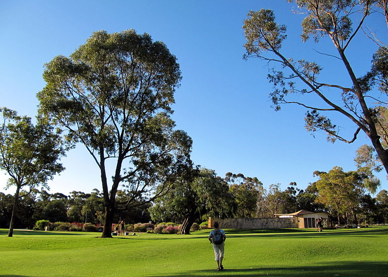 Fortunately set
aside in 1872, the park includes the lovely Western
Australia Botanical Gardens off Fraser Avenue, planted with
1700 native species; appropriately, the gardens host the
annual Wildflower Show in the spring. Also on Fraser Avenue
are an Education Centre (t 08 9480 3600), the State War
Memorial and Cenotaph, and several other sculptural
monuments. An Aboriginal art gallery also includes regular
performances and exhibitions. The best way to enjoy the park
is either by bicycle, which can be rented at the stand near
Fraser's Restaurant on Fraser Avenue, or simply by foot
through the many trails.
Fortunately set
aside in 1872, the park includes the lovely Western
Australia Botanical Gardens off Fraser Avenue, planted with
1700 native species; appropriately, the gardens host the
annual Wildflower Show in the spring. Also on Fraser Avenue
are an Education Centre (t 08 9480 3600), the State War
Memorial and Cenotaph, and several other sculptural
monuments. An Aboriginal art gallery also includes regular
performances and exhibitions. The best way to enjoy the park
is either by bicycle, which can be rented at the stand near
Fraser's Restaurant on Fraser Avenue, or simply by foot
through the many trails.
John Gould
John Gould (1804-81) had gained his reputation as a leading ornithologist with the publication in 1831 of his work on birds of the
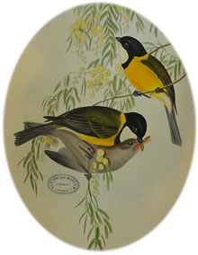 imalayas,
for which his wife Elizabeth (1804-41) had drawn and
hand-coloured the plates. The couple travelled to Australia
accompanied by their son John Henry (1830-55) in 1838-40 to
collect specimens and data which resulted in the magnificent
series, The Birds of
Australia (1840-48); its supplement appeared in 1869.
The illustrations, many of them completed by Elizabeth before
her untimely death, amounted to 681 hand-coloured lithographs,
making them the standard work on Australian birds, many of
which were relatively unknown at the time. Later, Gould also
produced a volume on Australian mammals, as well as his famous
five-volume set, The Birds
of Great Britain (1862-73). The Gould League was
founded in 1909 at the suggestion of Miss Jessie McMichael, a
Victorian schoolteacher who wished to emulate the American
Audubon Society in its efforts to interest children in bird
protection. The league originally promoted Bird Day, to be
observed in October; now the efforts of the organisation are
extensive, including bird-watching programmes and conservation
activities. Gould's illustrations from the Australian series
appear in many Australian museums and art galleries, most
notably at the National Library in Canberra.
imalayas,
for which his wife Elizabeth (1804-41) had drawn and
hand-coloured the plates. The couple travelled to Australia
accompanied by their son John Henry (1830-55) in 1838-40 to
collect specimens and data which resulted in the magnificent
series, The Birds of
Australia (1840-48); its supplement appeared in 1869.
The illustrations, many of them completed by Elizabeth before
her untimely death, amounted to 681 hand-coloured lithographs,
making them the standard work on Australian birds, many of
which were relatively unknown at the time. Later, Gould also
produced a volume on Australian mammals, as well as his famous
five-volume set, The Birds
of Great Britain (1862-73). The Gould League was
founded in 1909 at the suggestion of Miss Jessie McMichael, a
Victorian schoolteacher who wished to emulate the American
Audubon Society in its efforts to interest children in bird
protection. The league originally promoted Bird Day, to be
observed in October; now the efforts of the organisation are
extensive, including bird-watching programmes and conservation
activities. Gould's illustrations from the Australian series
appear in many Australian museums and art galleries, most
notably at the National Library in Canberra.Edith Cowan
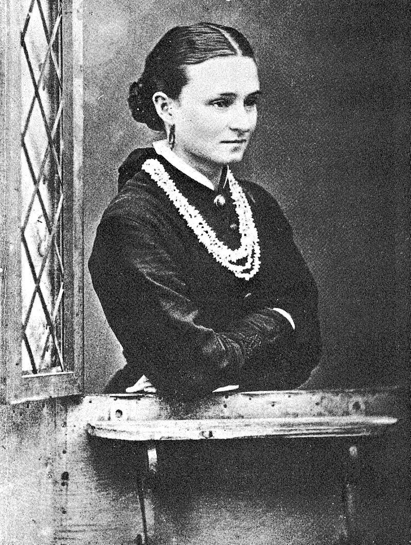 Edith Cowan (1861-1932)
was a much-loved figure in Western Australia, the founder of
professional social work in Australia and the first woman
member of any parliament in the country. She was born in
Geraldton of a prominent pioneer family (her mother was the
daughter of Rev. J.B. Wittenoom, for whom the Western
Australian town was named and who arrived in the colony in
1829). In 1879 in Perth, Edith married James Cowan, registrar
and master of the Supreme Court. When her husband became
police magistrate, she learned of the distressing situation
faced by many indigent women and children, and devoted the
rest of her life to their cause. She was a member of the
Children's Court in 1912, and was elected to the Legislative
Assembly in 1921. During her term she introduced the
groundbreaking Women's Legal Status Act and worked tirelessly
for reform of children's rights. when the university was
founded. The university overlooks Matilda Bay, and is
considered by many to be Australia's most beautiful campus
setting. The campus houses the Berndt
Museum of Anthropology (t 08 9380 2854; open Mon.-Fri.
9.00-17.00), with interesting collections of artifacts from
Western Australian Aboriginal groups, as well as material from
Melanesia and Southeast Asia; and the Fortune
Theatre (t 08 9380 3838), a replica of Shakespeare's
Fortune Theatre in London. Also near the campus on Mounts Bay
Road in Crawley are the Old Swan Brewery Buildings, built
between 1898 and 1918 by leading architect J.J. Talbot Hobbs.
Its site was chosen because it was next to a clear spring,
regarded by local Aborigines as a sacred site of the sleeping
rainbow serpent.
Edith Cowan (1861-1932)
was a much-loved figure in Western Australia, the founder of
professional social work in Australia and the first woman
member of any parliament in the country. She was born in
Geraldton of a prominent pioneer family (her mother was the
daughter of Rev. J.B. Wittenoom, for whom the Western
Australian town was named and who arrived in the colony in
1829). In 1879 in Perth, Edith married James Cowan, registrar
and master of the Supreme Court. When her husband became
police magistrate, she learned of the distressing situation
faced by many indigent women and children, and devoted the
rest of her life to their cause. She was a member of the
Children's Court in 1912, and was elected to the Legislative
Assembly in 1921. During her term she introduced the
groundbreaking Women's Legal Status Act and worked tirelessly
for reform of children's rights. when the university was
founded. The university overlooks Matilda Bay, and is
considered by many to be Australia's most beautiful campus
setting. The campus houses the Berndt
Museum of Anthropology (t 08 9380 2854; open Mon.-Fri.
9.00-17.00), with interesting collections of artifacts from
Western Australian Aboriginal groups, as well as material from
Melanesia and Southeast Asia; and the Fortune
Theatre (t 08 9380 3838), a replica of Shakespeare's
Fortune Theatre in London. Also near the campus on Mounts Bay
Road in Crawley are the Old Swan Brewery Buildings, built
between 1898 and 1918 by leading architect J.J. Talbot Hobbs.
Its site was chosen because it was next to a clear spring,
regarded by local Aborigines as a sacred site of the sleeping
rainbow serpent. Off Mounts Bay Road, travel along Matilda Bay on Hackett Drive to Australia II Drive, so named because it leads to the Royal Perth Yacht Club, whence came member Alan Bond to challenge and win the America's Cup in 1983. This unprecedented accomplishment stopped the entire nation, and the celebrations were long and ebullient. Subsequently, Fremantle became the site of the 1987 America's Cup race, the first time the event was held in the Southern hemisphere.
William Thomas Leighton
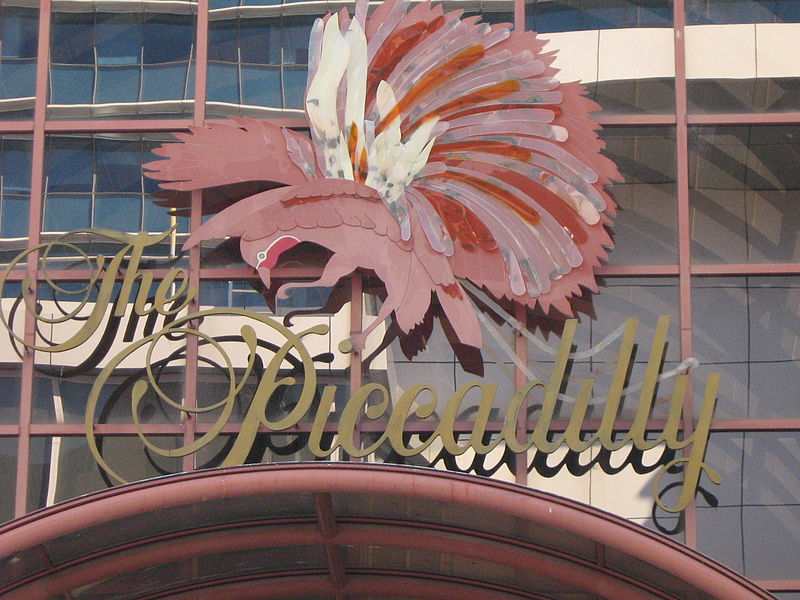
William Thomas Leighton (1905-90) was the architect responsible for a number of public buildings in Perth and Fremantle, particularly 1930s Art Deco and Art Moderne cinemas. Those still functioning include the Piccadilly Theatre and Arcade, 700 Hay Street, which was built for gold-mining entrepreneur Claude de Bernales in 1938 and is probably his best remaining design. The Ambassadors Theatre (1928, refurbished under his supervision 1939) is a good example of his early work. In the late 1930s he also received commissions for the Windsor Theatre on the Stirling Highway in Nedlands and the Cygnet (originally the Como), 16 Preston Street in South Perth. He refurbished a number of theatres, most of which are gone or, like the Princess Theatre (Fremantle), the Hoyts (Newtown) and the Lyric (Bunbury), now have alternative uses. Some of his public buildings include the Fremantle Port Authority's Passenger Terminal, the Institute of Agriculture Building on the University of Western Australia's campus, and the Devon House in Central Hay Street. The latter two are excellent examples of his use of International Style modern proportions and Art Deco ornament.
North of Central Perth
Herdsman Lake Settlers Cottage (t 08 9321 6088) is about 5km northwest of central Perth via Selby Street. Herdsman Lake is now the headquarters for the Gould League, the Australian bird watchers' society named, like the Audubon Society in the USA, after an eminent early ornithologist and artist. See the note on John Gould above. The state government built the cottage here in 1931 as part of an agricultural settlement scheme.
South Perth
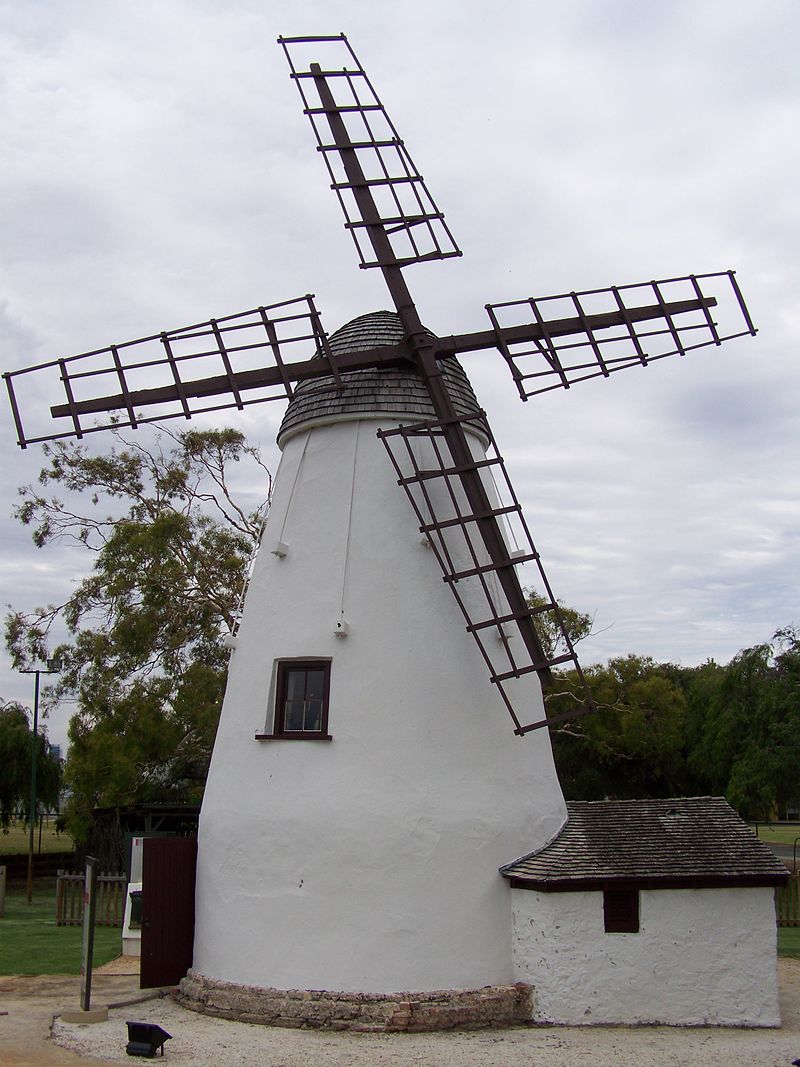
The Old Mill (t 08 9367 5788; open daily 10.00-16.00) can be reached by foot across Narrows Bridge or most pleasantly by ferry from the Barrack Street Jetty across the Swan River. This extremely popular historic landmark functioned as a flour mill from 1835 until 1859. Known as Shenton's Mill due to its owner William Kernot Shenton, it was subsequently a residence, wine saloon, poultry farm and eventually a protected site under the National Trust. Its foundation stone was laid by Governor Stirling, and the building now contains important furnishings and artefacts from Perth's early colonial days.
Also on this side of the river, on Labouchere Road (Mill Point Road veers right at Labouchere Road), are the Zoological Gardens, that is, Perth Zoo (t 08 9474 0444; open daily 09.00-17.00; admission adults $29, concession $22, children $14). The area for the zoo, situated on the river, was reserved in 1896. The landscaping was carried out by the first director, A. Le Soeuf, with the assistance of Andrew Wilkie, who had worked at the Melbourne Zoo. One intriguing facet of the zoo is that the main water supply for the grounds comes from a deep artesian well, which pumps up water with a surface temperature of 39º C; this makes it possible to house tropical flora and fauna at a constant temperature. The zoo is one of the most popular in Australia; it has recently made concerted efforts to create natural enclosures for animals, and conducts a successful research and breeding programme for endangered animals.
Eastern Perth
 Peninsula
Farm, also known as Tranby House (t 08 9272 2630, open
Fri.-Sun. 12.30-16.00, closed Easter Friday and July,
admission adults $8, concession $5, children under 5 free) is
about 10 minutes' drive 6km east from Perth's city centre, on
the next loop up the river in Maylands. Take Lord Street,
route 51, which continues as Guildford Road, c 3km; turn right
on Peninsula Road and travel c 3km to the National Trust
property. Transperth buses nos 42 and 43 pass nearby, and a
Transperth ferry stops here. Some of the river cruise boats
will also stop here. This section of town was largely
settled by a group of Wesleyan Methodists who migrated to
Australia aboard the brig Tranby, arriving in Perth in 1830
after a voyage of 147 days, ten of which were spent ashore at
the Cape of Good Hope.
Peninsula
Farm, also known as Tranby House (t 08 9272 2630, open
Fri.-Sun. 12.30-16.00, closed Easter Friday and July,
admission adults $8, concession $5, children under 5 free) is
about 10 minutes' drive 6km east from Perth's city centre, on
the next loop up the river in Maylands. Take Lord Street,
route 51, which continues as Guildford Road, c 3km; turn right
on Peninsula Road and travel c 3km to the National Trust
property. Transperth buses nos 42 and 43 pass nearby, and a
Transperth ferry stops here. Some of the river cruise boats
will also stop here. This section of town was largely
settled by a group of Wesleyan Methodists who migrated to
Australia aboard the brig Tranby, arriving in Perth in 1830
after a voyage of 147 days, ten of which were spent ashore at
the Cape of Good Hope. The house, also known as Tranby House, was built in 1839 as part of a farm owned by Joseph and Ann Robinson Hardey. Joseph Hardey was an ardent Methodist, acting as a preacher until the Rev. John Smithies arrived and provided a substantial portion of the funds necessary to erect the Methodist church on the corner of William and Hay Streets in downtown Perth in 1870. The house is set in a garden with 100-year-old oak trees and is furnished with original objects brought to the colony by the Hardeys, as well as period furniture from the 1850s.
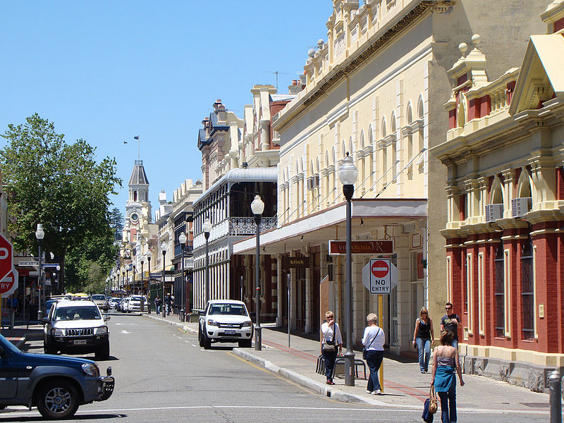
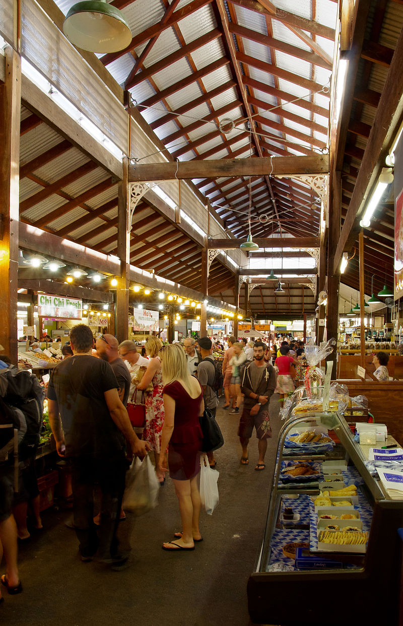
Only 19km from Perth, the port of Fremantle (population 25,000) at the mouth of the Swan River is an architectural gem, with more than 150 buildings classified by the National Trust. Still a thriving port city, its maritime atmosphere makes for continuous activity and variety for visitors. Tourist information: Town Hall, St John's Square, High Street; t 08 9430 2346.
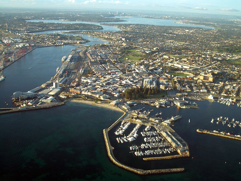
To get there by car from Perth, follow Stirling Highway past the Kings Park Botanic Gardens, the University of Western Australia and Peppermint Grove to Fremantle. The train to Fremantle follows a route north of the park. Along the way look out for the Claremont Railway Station at Leura Avenue, a two-storey stone building from 1887, designed by George Temple Poole. At the southern end of Bay Road, turn left on Victoria Avenue to reach almost immediately the Claremont/Freshwater Bay Museum (t 08 9340 6983; open Mon-Fri 13.00-16.00, first Sun. 14.00-17.00, free admission, contributions accepted), a delightful local history museum on Freshwater Bay. The building is known as the Freshwater Bay School, and was built in 1862 by convicts and the community of Pensioner Guards. The entire suburb of Claremont is filled with elegant houses and upmarket art galleries and boutiques. Bayview Terrace, c 600m west of Claremont Museum, is one of Perth's most fashionable shopping precincts.
Trains from Perth to Fremantle leave regularly from the central station, and several buses, including nos 102-106, leave the City Busport on Wellington Street and stop in Fremantle.
History
Fremantle's first settlers arrived in the winter of 1829. The conditions were severe. No housing had been provided; at the end of the first season, the visiting Miss Friend thought that the town resembled 'a country fair and has a pretty appearance, the pretty white tents looking like booths'. In 1834 the Colony's Advocate-General, George Fletcher Moore, observed that the city had 'a few wooden houses among ragged-looking tents and contrivances for habitation. The colonists are a cheerless, dissatisfied people with gloomy looks, who plod through the sand from hut to hut to drink grog and grumble out their discontent to each other.'
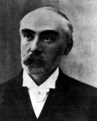
Visiting adventurer Charles von Hügel's description is somewhat less condemnatory: 'A few of the residents, not exactly in Sunday best, let alone in clean clothes, were standing on the bank fishing. Others-it being evening-were weaving their unsteady way through the sand, unmistakably under the influence of the spirits they had consumed. Despite the dirt, their faces all glowed with rude health, and the children splashing about in the water could certainly vie with any European street urchins.'
By the end of the 1840s, however, the town had become a health resort for tourists from India and a trans-shipping point for goods moving up or down river. Land transport to Perth was facilitated in 1866 by the construction of the River Swan bridge to North Fremantle. An interesting, and apocryphal, anecdote relating to the bridge maintains that the first person to cross it was an Irish political prisoner named John Boyle 'Moondyne Joe' O'Reilly, who managed to escape from the Bunbury prison (about 150km south of Perth) on the night before its dedication. He subsequently settled as a newspaperman in Boston, where he organised the escape of six of his fellow Fenian transportees remaining in Western Australia.
As a port, Fremantle has a controversial history. Originally piers stood quite open on the western edge of town, ships standing at anchor and their cargoes lightened ashore often by nimble-fingered thieves. The river offered more than adequate protection from such robbery, but was blocked by sandstone bars.
 Based on new methods of
dredging, Irish engineer Charles Yelverton O'Connor
(1843-1902) challenged renowned British engineer John Coode's
assertions regarding the feasibility of constructing an inner
harbour. Between 1892 and 1900, the new harbour and Victoria
Quay were completed. O'Connor was also responsible for the
water pipeline from the Darling Range to the eastern gold
fields (350 miles) and the extensive enlargement of the
state's rail system. The Pipeline
basically follows national highway 94 from Mundering Weir (08
9321 6088 for admission information; a number of venues are
along the pipeline) above Perth to the Charlotte Reservoir
near Kalgoorlie-Boulder. Tragically, O'Connor succumbed
to the pressure of criticism from avaricious landowners hoping
to profit from the Coolgardie pipeline and took his own life
in 1902. Beyond his engineering vision, he was brilliant at
fiscal matters. His water pipeline, for instance, was
completed within a year of his death at a cost consistent with
that he had estimated, an unprecedented accomplishment in
those days.
Based on new methods of
dredging, Irish engineer Charles Yelverton O'Connor
(1843-1902) challenged renowned British engineer John Coode's
assertions regarding the feasibility of constructing an inner
harbour. Between 1892 and 1900, the new harbour and Victoria
Quay were completed. O'Connor was also responsible for the
water pipeline from the Darling Range to the eastern gold
fields (350 miles) and the extensive enlargement of the
state's rail system. The Pipeline
basically follows national highway 94 from Mundering Weir (08
9321 6088 for admission information; a number of venues are
along the pipeline) above Perth to the Charlotte Reservoir
near Kalgoorlie-Boulder. Tragically, O'Connor succumbed
to the pressure of criticism from avaricious landowners hoping
to profit from the Coolgardie pipeline and took his own life
in 1902. Beyond his engineering vision, he was brilliant at
fiscal matters. His water pipeline, for instance, was
completed within a year of his death at a cost consistent with
that he had estimated, an unprecedented accomplishment in
those days.Much of the city of Fremantle itself was built in the 1880s in a Classical style. The incredible consistency of limestone and the darker window frames suggests that the designs conspire with the elements to make Fremantle a city of light.
A walk around town
This walk begins at the station's car park, makes its way to the Fremantle Museum and Arts Centre (about 10 minutes), then goes past the Gaol and back through the centre to the Round House at Arthurs Head. A free Tripper Bus operates on weekends, running in a loop around this tour's area. The Railway Station is situated on Victoria Quay Road, parallel to the inner harbour, with a cluster of late-19C warehouses in a pocket a little to the south and seaward. Rail transport began along the Fremantle-Perth-Guildford route in 1881. The current station opened in 1907. The building is made from Donnybrook sandstone. Immediately in front of it is a watering trough and drinking fountain from 1905, commemorating the loss of Englishman John Taylor's sons Ernest and Peter who died in Western Australia.
You will find Fremantle Tourist Bureau's Office by walking down Market Street, directly in front of the station, and across the mall at the corner of William and Adelaide Streets in the Fremantle Town Hall. From here the Fremantle Tram departs on the hour, giving 45-minute tours of the town. Also here, on the square on Adelaide Street, is St John's Anglican Church. Designed in London by W. Smith, it was built around 1880, and was originally intended to have a tower and steeple. The floors are jarrah; the bell turret is from 1907. Architect Robin McKellar Campbell mentions that the membership was convinced to build this replacement somewhat to the north of the original, allowing the site for the Town Hall.
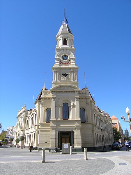
The Town Hall (beside St John's) has been largely unaltered since its construction in 1885-87. This late Victorian building was designed by Melbourne architects Grainger and D'Ebro and built by E. Keane. A local watchmaker, W. Hooper, imported its clock from England in 1888.
A bit further along Adelaide Street at Parry Street is Proclamation Tree, an enormous Moreton Bay fig planted in 1890. From here either walk through the park to Ord Street then left to the Fremantle Museum and Art Centre or continue along Quarry Street past the former Boys' and Princess May Schools. The Boys' School is now the Film and Television Institute; its administration is housed in William Leighton's Princess Theatre (see box on Leighton), left to the north, past the car park, right on Edward Street. Thought to have been designed by Sanford in 1852, the renovations and additions to this Victorian Revival building are sometimes compatible enough to be a challenge to identify. Princess May School is currently a Community Education Centre. Constructed in 1902, on adjacent land set aside for a girls' school in 1894, the design is a conscious attempt to match the Boys' School. This two-story institutional building offers a vista from its tower. Prior to its dedication, girls attended the adjacent Boys' School.
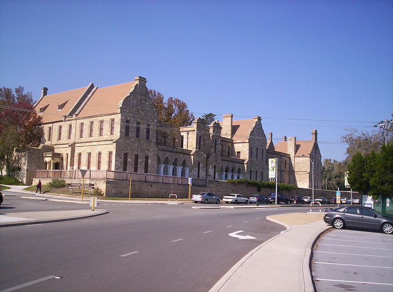
The Fremantle Arts Centre (t 08 94329555, open daily 10.00-17.00, free admission) is east of the schools, left at the
 Celtic Cross along
Quarry Street to its junction with Ord Street; a short jag
leads to the entrance on Finnerty Street. Originally the
lunatic asylum contiguous with the gaol, it was designed by
Captain Henderson and built by convict labour in the 1860s.
After various uses, it was renovated by architect Robin
McKellar Campbell and opened to the public as a museum in 1970
and as an art centre in 1972.
Celtic Cross along
Quarry Street to its junction with Ord Street; a short jag
leads to the entrance on Finnerty Street. Originally the
lunatic asylum contiguous with the gaol, it was designed by
Captain Henderson and built by convict labour in the 1860s.
After various uses, it was renovated by architect Robin
McKellar Campbell and opened to the public as a museum in 1970
and as an art centre in 1972.The most significant part of the historical collections is the display and description of the many ships of the Dutch East India Company which explored and were wrecked along the Western Australian coast.
The arts centre presents sometimes challenging changing exhibitions of Australian artists. The Western Australian History Museum is in the other wing of the centre and includes excellent changing exhibitions depicting the early social history of Fremantle. It was the original home of a visionary and successful publishing house, the Fremantle Arts Centre Press, now independent. As you might expect, the bookstore here is worth the trip itself.
The next stop is the Fremantle Prison Gates and Museum. To reach them, cross Ord Street to Fremantle Park. Continue diagonally across the park to Parry Street, follow it to Holdsworth Street, which leads to Fairbairn Street and The Terrace. This a bit of a detour, but the Gaol Gateway and Prison Museum are both interesting (open daily 9.00-17.00, a variety of tours are offered at varying prices). Both structures were designed by H. Way and James Manning in a Georgian style uncommon in the colony at that time (1855). The limestone was quarried locally, but the most visible parts were stuccoed shortly after the buildings were erected. The walls, incidentally, are 5m high. The museum was originally the superintendent's residence. The site was used as a maximum security prison from 1855 until 1991, when it became a cultural heritage centre.
 Return to Fairbairn
Street, take Parry Street around the Fremantle Oval; at
Henderson Street are the Fremantle
Markets, designed by Oldham and Eales and built in the
late 1890s. The iron gates are original. The market (t 08 9335
2515) has operated continuously since 1897, offering both
produce and handicrafts. It is open Friday-Monday 8.00-20.00.
Return to Fairbairn
Street, take Parry Street around the Fremantle Oval; at
Henderson Street are the Fremantle
Markets, designed by Oldham and Eales and built in the
late 1890s. The iron gates are original. The market (t 08 9335
2515) has operated continuously since 1897, offering both
produce and handicrafts. It is open Friday-Monday 8.00-20.00.Across South Terrace are the Technical School buildings. That on the right dates from 1912. The use of Donnybrook stone for the plinth and facings provides a handsome Art Nouveau style designed by H. Beasley. The other was originally an Infants and Girls School which dates from 1877. South Terrace is known as Cappuccino Strip, famous for its many outdoor cafes and great coffee.
Leaving the markets, take South Terrace one block east, then left down Collie Street. At Marine Terrace, facing the Esplanade Reserve, is a handsome Victorian corner pub, the Esplanade Hotel, dating from 1897. Continuing east along the reserve leads to the Old Court House, the Maritime Museum and the Round House.
 The Maritime Museum (t 08
6552 7800, open daily 9.30-17.00, admission adults $15, kids
free, concession $750) was built as a commissariat store
between 1851 and 1862 using Lieutenant H. Wray's designs. The
Colonial Government converted the structure into a Customs
House in 1878. It opened as the Maritime Museum in 1977 with
displays which include marine archaeology, especially 18C
Dutch shipwrecks on the Western Australian coast. The boat
shed or Historic Boats Museum (t 08 9430 4680; open Mon-Fri
10.00-15.00, weekends 11.00-16.00) nearby on the Victoria Quay
of the inner harbour immediately north has an extensive
display of functional boats, including modern racing yachts.
Marine engines operate on Thursday-Sunday afternoons.
The Maritime Museum (t 08
6552 7800, open daily 9.30-17.00, admission adults $15, kids
free, concession $750) was built as a commissariat store
between 1851 and 1862 using Lieutenant H. Wray's designs. The
Colonial Government converted the structure into a Customs
House in 1878. It opened as the Maritime Museum in 1977 with
displays which include marine archaeology, especially 18C
Dutch shipwrecks on the Western Australian coast. The boat
shed or Historic Boats Museum (t 08 9430 4680; open Mon-Fri
10.00-15.00, weekends 11.00-16.00) nearby on the Victoria Quay
of the inner harbour immediately north has an extensive
display of functional boats, including modern racing yachts.
Marine engines operate on Thursday-Sunday afternoons. The Old Court House, across Mouat Street from the Barracks on Marine Terrace, was built in 1883-84 by Harwood and Sons. Like their design for the railway station, it is of stone in a Classical style with semicircular arches around its windows. After a number of civic uses, the building was given to the Salvation Army. More recently, it has been a centre for food distribution and welfare services for the Uniting Church.
The University of Notre Dame (Australia) is nearby at 19 Mouat Street, situated neatly in one block. It allows some public access to the interior of several restored limestone warehouses. The university is affiliated with the University of Notre Dame in Indiana, United States, having an active exchange programme with them and organising the curriculum along Catholic university lines-an unusual situation among Australian universities.
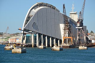
From the university, take High Street down to Bathers Bay and Arthur Head. Here is the Round House and Whaler's Tunnel (t 08 9336 6897, open daily 10.30-15.30), dating from 1831 and probably the oldest structure in the state. Rather than round, it has twelve sides. It was designed by Henry W. Reveley, the colony's first engineer, as a prison; it includes the Whalers' Tunnel, cut in 1837 to connect High Street to the beach. The limestone was quarried on site. There is an excellent view of the harbour from the west side of the structure. From here you can easily walk diagonally towards Victoria Quay and the Fremantle Port Authority at Cliff Street. The authority's observation tower offers spectacular views out to the Indian Ocean, as well as explanations of the port's still-busy activities. In addition, the Maritime Museum (9.30-17.00) has displays describing WA's relationship to the ocean, ferry services depart from the port, and it is a good place for dolphin sightings.
From the Port Authority return via Cliff Street to High Street. Walking up High Street through the warehouse and commercial district of Fremantle presents evidence of the area's success following the late-19C gold rush. The Samson Building, for example, dates from 1898 and is typical of the Georgian-style architecture at the end of this period. The owners, Lionel Samson Pty Ltd, were granted the lot as spirit merchants in 1829 and have been operating here since that time.
 The Samson
House (t. 08 9321 6088, open first Sunday of the month,
tours 10.30 and 12.00, admission $8, concession $5.00,
children under 5 free, and by appointment for group tours) is
located on the corner of Ord and Ellen Streets (61 Ellen St.).
It was designed in 1900 by J.J. Talbot Hobbs for Michael
Samson, who became Fremantle's mayor. Built of limestone, the
house has original furnishings.
The Samson
House (t. 08 9321 6088, open first Sunday of the month,
tours 10.30 and 12.00, admission $8, concession $5.00,
children under 5 free, and by appointment for group tours) is
located on the corner of Ord and Ellen Streets (61 Ellen St.).
It was designed in 1900 by J.J. Talbot Hobbs for Michael
Samson, who became Fremantle's mayor. Built of limestone, the
house has original furnishings.To return to the railway station, turn down Ellen left onto Parry right onto High Street past St John's Church then right on Market Street walking past the ornate Post Office. The first postal service in the colony was carried between Fremantle and Perth by a runner who was paid a wage of about £1 per week. The service was private until 1835 when John Bateman was appointed post- master. The first stamp in the colony, used in 1854, was a black swan designed by the British firm Perkins Bacon. In a few instances, this design was mistakenly inverted, creating one of the most valuable stamps among philatelists. This neo-Romanesque building was erected in 1906.
Rottnest Island
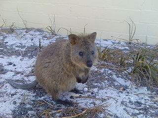 Rottnest
Island (t 08 9432 9111) measures 11km long by 4.5km
wide. It was in the 19C-like so many other islands around
Australia-an horrendous penal colony for Aborigines. It has
five salt lakes (Government House Lake and Lake Bagdad being
the two largest), a lighthouse, 40km of coastline and a
variety of modes of accommodation.
Rottnest
Island (t 08 9432 9111) measures 11km long by 4.5km
wide. It was in the 19C-like so many other islands around
Australia-an horrendous penal colony for Aborigines. It has
five salt lakes (Government House Lake and Lake Bagdad being
the two largest), a lighthouse, 40km of coastline and a
variety of modes of accommodation. This limestone island was named by Dutch explorer Willem de Vlamingh in 1696 who mistook the quokka, a native wallaby on the island which can be quite tame, for large rats. Currently a holiday venue allowing no personal cars, it can be reached by ferry. The trip is 30 minutes from Fremantle, a little over an hour from Perth. Three ferry companies provide the service, Rottnest Express, (t 1 300 467 6888, departs Barrack Street Jetty, Perth; Victoria Quay, Fremantle; and Northport, North Fremantle) or Rottnest Fast Ferries (08 9246 1034, departs Hillary's Ferry Terminal, Sorrento). An information post at the Island's jetty provides a number of brochures describing the island. Thompson Bay is the island's main settlement. The beaches here are spectacular. School holidays mean tremendous crowding here, so be mindful of these times, and book accommodation well ahead!
Day trip east of Perth
Travelling across the Perth's Causeway to the Great Eastern Highway (or, alternatively, north on Lord Street to Guildford Highway) leads to Guildford and John Forrest National Park, eventually reaching York. Transwa provides bus connections to York and beyond (t 1300 662 205), and many tours to the region can be arranged through Perth's tourist centre on Forrest Place (t 08 9483 1111).
About 20km from Perth along route 51, the Great Eastern highway, is the small town of Guildford, planned in 1830 as the first settlement east of Perth. H.C. Sutherland, the assistant surveyor for the colony, set it at the confluence of the Swan and Helena Rivers as an inland port and market town. From here the Swan Valley Heritage Trail begins (see below), a 40km drive along the trail of Captain Stirling's 1827 exploration; follow the signs from Success Hill Reserve, where Stirling's party first found fresh water. In Guildford, the Garrick Theatre (1853) was the original Commissariat Store and Headquarters, devoted to storing road building materials and equipment for the convict work parties. Vineyards were established in the surrounding Swan River Valley in the 1860s, making this region today the oldest wine-producing area in Western Australia.
The Old Courthouse and Gaol on Meadow Street (t 08 9379 1829; open Tues.-Fri. 10.00-14.00, Sat. 10.00-14.00), also established in the 1860s, is now a local history museum. On Swan Street is the Rose & Crown Hotel (t 08 9347 8100), which opened as an inn in 1841; it is the oldest trading hotel in Western Australia. The hotel was in the 1890s an important stop for travellers to the gold fields further east.
To the north of Guildford the Upper Swan Valley begins, with its beautiful scenery and its many well-established wineries. 7km north of Guildford via route 52 (or from Bayswater north via route 4) is Whiteman Park (t 08 9209 6000), one of Perth's most popular bushland parks. With 26 sq km of parkland-six times the size of Kings Park-the park offers a variety of walking and cycling tracks, picnic areas and playgrounds. A tram in the park connects the picnic areas with a craft village, farm machinery museum, old railway displays, and camel and emu rides.
Also north of Guildford on route 52 is the village of Henley Brook, situated in picturesque surroundings. Here on Henry Street is All Saints Church, a small rammed-earth building opened for worship in 1841 at the furthest point inland reached by Captain Stirling when he explored the Swan River in 1827. It is the oldest church in Western Australia. Next door to the church is Henley Park Wines (t 08 9296 4328), one of the older wineries among the many in this region, most of which provide tastings and cellar sales.
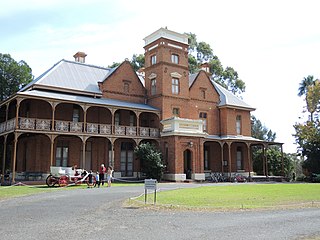 A little further east
on the Great Eastern Highway is Midland; and on Third Avenue
and Ford Street is Woodbridge
House (t 08 9274 2432; open Thurs.-Sun. 13.00-16.00;
admission adult $5, children and concession $3, children under
5 free; closed July). The house first built on this land was
named by Governor James Stirling after his wife's family's
home in Surrey. The original house stood on a high bank
overlooking the Swan River. Charles Harper, MP and leading
publisher, had the current house built in 1885 by local
contractors, the Wright Brothers. Harper improved the
agricultural land by the addition of superphosphate and
cultivation of clover, the use of artisian water, and an
innovative inexpensive method of fencing. A number of
pleasant stories date from Harper's time--his billiard room
becoming the first neighbourhood school is one anecdote
favoured by the volunteer guides of the National Trust. This
school eventually became the Guildford Grammar School. Passing
from the Harper family in 1921, the property served as the
school and then a home for aged women before the National
Trust began its stewardship in the late 1960s. The house is
furnished in typical late Victorian and early Edwardian
fashion.
A little further east
on the Great Eastern Highway is Midland; and on Third Avenue
and Ford Street is Woodbridge
House (t 08 9274 2432; open Thurs.-Sun. 13.00-16.00;
admission adult $5, children and concession $3, children under
5 free; closed July). The house first built on this land was
named by Governor James Stirling after his wife's family's
home in Surrey. The original house stood on a high bank
overlooking the Swan River. Charles Harper, MP and leading
publisher, had the current house built in 1885 by local
contractors, the Wright Brothers. Harper improved the
agricultural land by the addition of superphosphate and
cultivation of clover, the use of artisian water, and an
innovative inexpensive method of fencing. A number of
pleasant stories date from Harper's time--his billiard room
becoming the first neighbourhood school is one anecdote
favoured by the volunteer guides of the National Trust. This
school eventually became the Guildford Grammar School. Passing
from the Harper family in 1921, the property served as the
school and then a home for aged women before the National
Trust began its stewardship in the late 1960s. The house is
furnished in typical late Victorian and early Edwardian
fashion. Midland also holds a popular market: the Midland Farmers Markets, at the Crescent car park each Sunday (7.00-15.00), selling food and speciality goods.
North of Midland on the Great Northern Highway is the Swan Valley, with its many vineyards and wineries. For tours and maps, check with the Swan Valley Tourist information centre, Swan and Meadow Streets (t. 08 9207 8899). The most historic of these wineries is Houghton Winery (t 08 9274 9540; open daily), Dale Road, Middle Swan (c 5km north of Midland via the Great Northern Highway, near 1/95). The property was acquired in 1833 by T.N. Yule and bought in 1839 by colonial surgeon John Ferguson, who established the vineyards. Ferguson's homestead, built in 1863, is incorporated into the present-day winery grounds, making it one of the prettiest wineries in the state. Houghton's popular white burgundy is known internationally; a museum cellar chronicles the history of Western Australian winemaking, and the beautiful lawns make for great picnicking.
From Middle Swan, continue north c 20km (on Highway 1) to Walyunga National Park. Situated along the Darling Escarpment, the park is bisected by the Avon River, which rushes swiftly through a narrow gorge to join the Swan River. The park's steep drop in elevation, from 280m to 30m above sea level, has produced spectacular and rugged scenery. Walking tracks pass through forests of wandoo and marri trees, with magnificent wildflowers in the spring and winter. This escarpment also marks the end of the Swan Valley.
From Midland, continue west on the Great Eastern Highway (route 94) on the old road to York. At Mahogany Creek (c 11km) is the Old Mahogany Inn, believed to be the oldest licensed inn in Western Australia and still in use. The inn dates from 1837, although the building's appearance is largely due to additions in 1847 and 1848.
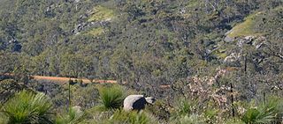
Also en route are the John Forrest National Park and Kalamunda National Park, c 12km south of the Great Eastern Highway. Each park has wonderful displays of wildflowers in spring (August to October). John Forest has long been a popular venue for Perth residents; it remains a pleasant and accessible park near the Mundaring Weir. The weir was part of C.Y. O'Connor's method of providing water to the gold fields. The No 1 Pump Station (t 08 9295 2455; Sat., Sun., public holidays 12.00-16.00; admission adults $8, concession $5.00, children under 5 free) has a display describing the project, built in 1903 and pumping water 560 kms to the gold fields. Kalamunda is a fairly small park, but easily accessible off the Great Eastern Highway on Kalamunda Road. Buses 300 or 302 (via Maida Vale) and 292 or 305 (via Wattle Grove), all from stop no. 43 in St George's Terrace, Perth, make the trip to Kalamunda as well.
Kalamunda National Park is also the starting point for the Bibbulmun Track, Western Australia's only long-distance walking trail, and one of the longest, continuously marked trails in the country. It is named for the Bibbulmun people who inhabited this region. It continues 1000km from here to Walpole on the south coast. Accommodation in shelters is available along the track.
York
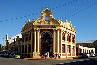
Another 60km from Mundaring Weir, 97km from Perth, is York (population 1950), founded in 1831 on the Avon River, making it the oldest inland city in Western Australia. Tourist information: 105 Avon Terrace; t 08 9641 1301; open 9.30-16.00. As a wheat-producing region, the York valley has provided the state with agricultural products since its founding. Much of its civic architecture dates from the early 1890s and remains largely unchanged. Earlier structures relate to the jurisprudence in the district.
The Old Gaol and Courthouse (t 08 9641 2072; open Thurs.-Mon. 10.00-16.00, admission $5, children under 5 free) on Avon Terrace, north of the Great Southern Highway, present the prison cell block, the stables and trooper's cottage, built in 1838 with additions in 1873, 1893, and 1907.
To travel to the Yilgarn area's gold fields, prospectors would catch the train on the south coast at Albany, provision themselves in York and continue on foot to the gold fields. This prosperity slackened in 1894 when the train to the Coolgardie and Kalgoorlie mines from Perth passed through Northam, about 30km north of York.
Noteworthy early buildings in York in addition to the Old Gaol include the Residency Museum, Brook Street (t 08 9641 1751; open Tues- Thurs 13.00-15.00, weekends and holidays 11.00-15.30), a bungalow with verandah and iron roof. It dates from 1843 and was restored by the York Society. The Church of the Holy Trinity (1858 with additions in 1873, 1893, and 1907) replaced the area's first church (1858); St Patrick's (1887), the Roman Catholic church for the area, similarly replaced the original structure (1852). Settler's House, a bed and breakfast with a long verandah and courtyard, was built in 1853 and enlarged in 1877.
The Castle Hotel dominates the intersection of York's two primary streets, South and Avon. This brick building with comfortable verandah and balcony is one of the state's oldest hotels. Most of the buildings in this section of town date from the late 19C. Balladong Farm, probably the area's first farm and situated at the southern end of town, has buildings dating from the 1850s. Opposite the tourist office on Avon Terrace is the York Motor Museum (t 08 9641 1288; open daily 09.30-14.00; admission $9, seniors $6.50, children $4), a truly impressive collection of antique cars. At the end of the Terrace is evidence of the old Sandalwood Yards, a reminder of the proliferation of this aromatic wood throughout Western Australia during colonial days. Appropriately named, the Sandalwood Press (t 08 9641 1301) is also located in York; on McCartney Street, the press is now the state's only working printing museum, with tours available by appointment.
A 30-minute drive south from Perth on the Western Highway leads to Pinjarra; alternatively it can be reached from Fremantle on Highway 1 to Mandurah, then east (it is also accessible by train). In addition to its lovely rose garden, which conveniently blossoms at the opposite end of the year from the wildflower season, south of Pinjarra on the South West Highway is Old Blythewood (t 08 9531 1485; open Sat., Sun. and public holidays 10.30-15.30; admission adults $8, concession $5, children under 5 free). The great-grandsons of John McLarty, its builder, donated this brick farmhouse from the 1860s, with verandahs and lovely gardens, to the National Trust. In its heyday at the beginning of the 20C, it functioned as an inn for coaches and a post office. In the vicinity are a variety of waterbird reserves. A steam railway runs from Pinjarra to nearby Dwellingup, which offers great views of the ocean on entering town.
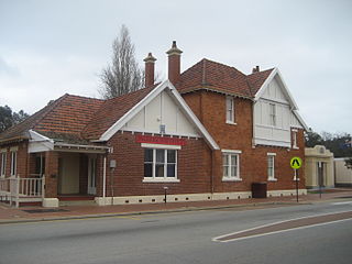
The road south beyond Pinjarra leads to Bunbury and the southwest region of the state. Albany, the holiday resort Esperance, and Kalgoorlie-Boulder are vacation destinations popular among Western Australians. The southwest region is known for agriculture, timbering and excellent surfing around Margaret River. Transwa provides a bus service to the region, and the train runs between Perth and Bunbury.
This region, and east into the heavily timbered sections of the state, was relatively densely inhabited by Aboriginal groups before white settlement, especially in the summer months, when large bands gathered to 'fire' the country; controlled fires were lit to drive out game and to promote new growth. Archaeological excavation demonstrates that Aborigines lived here from at least 27,000 years ago.
Just north of Bunbury (11km) is Australind (population 5694), site of an ill-fated settlement in the 1840s which planned to breed horses for the Indian Army (hence the name). The town is now a popular fishing resort, noted also for the Church of St Nicholas (1842), at 4 x 7m the smallest church in Western Australia.
Bunbury
Only 180km south of Perth, and accessible by train, Bunbury (population 26,550) is one of the state's most popular tourist resorts as well as the major industrial port of the region. The French in 1803, aboard the ships Casuarina and Géographe, explored the area, naming this point Port Leschenault, in honour of the expedition's botanist. With the settlement of the Swan River colony in 1829, favourable reports about the area led to further exploration; in 1836, the town site was selected, and named after Lieutenant Henry Bunbury, who had made an overland trek from Pinjarra to the district and published the journal of his findings.
Today, the town has a nice Regional Art Gallery in Wittenoom Street (t 08 9792 7323; open daily 10.00-16.00; free admission), located in a former convent built in the 1860s. King Cottage Museum (t 08 9721 7546; open daily 14.00-16.00; admission adults $10, children $7), on Forrest Avenue, is an 1870s house now run as a historic house by the Bunbury Historical Society.
There are some pleasant drives along the harbour and coastline. Indeed, the area's greatest attractions are its stunning white beaches and, at Koombana Beach, a 'swimming with the dolphins' opportunity less fraught with tourist hype than the experience at Monkey Mia north of Perth. Tourist information: Old Railway Station, Carmody Street; t 08 9721 7922.
From Bunbury, take the Bussell Highway, route 10, another 100km south to Margaret River. Tourist information for the region includes Busselton, Dunsborough, Margaret River and Augusta (t. 089780 5911). The highway travels around Géographe Bay and past Busselton (population 10,700), a popular seaside resort, named for the pioneering family of John Bussell, who settled the area in the 1830s. Tourist information at Civic Centre Complex, Southern Drive. About 26km west of Busselton is Yallingup on the Indian Ocean, known by surfers for its stupendous waves, but also for its limestone caves, the northernmost of this cave system. A famous story of the region concerns the rescue of shipwreck survivors off the coast here by an Aboriginal stockman Sam Isaacs and Grace Bussell in 1876.
Some 7km northwest is Ellensbrook (t 08 9755 5173; open Thurs.-Sat. 10.00-16.00; admission adults $8, children and concession $5, children under 5 free), the wattle-and-daub farmhouse of pioneers Alfred and Ellen Bussell, built in the 1850s. It is now owned by the National Trust. Nearby, about 30 minutes' walk, is Meekadarribee Falls, an unusually spiralling waterfall that is worth the view. Ellensbrook Homestead and Meekadarribee Falls are situated within one section of Leeuwin-Naturaliste National Park (t 08 9752 5555), a wonderful park broken up in segments running along the 120km of coast from Bunker Bay at Cape Naturaliste in the north to Cape Leeuwin near Augusta in the south. Along with windswept views of this rugged coastline, parts of the park include the Boranup Karri Forest (near Hamelin Bay, c 35km south of Margaret River), an unusual stand of these enormously tall trees (some up to 60m, and most them 100km inland from here). Camping facilities are available in the park, and walking trails for every level of bushwalker are well marked.
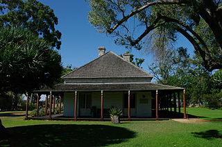 To the east of
Busselton (c 10km on Layman Road) is Wonnerup
House (t 08 9752 2039; open Thurs.-Mon. 10.00-16.00;
admission adults $8, children and concession $5, childen under
5 free), another National Trust property. Built in 1859 by
pioneer George Layman, the stone house and many out-buildings
contain family memorabilia and colonial artefacts. In
the late 19C Lyman Families' dairy was one of the district's
largest. In the 1870s, when the local residents
expressed a need for a local school, George Layman donated the
building for the property's associated school house.
Layman became involved in a local aboriginal dispute and was
speared to death by Wardandi elder Gaywal. The result
was a reprisal with considerable blood shed by the local
Aboriginal people.
To the east of
Busselton (c 10km on Layman Road) is Wonnerup
House (t 08 9752 2039; open Thurs.-Mon. 10.00-16.00;
admission adults $8, children and concession $5, childen under
5 free), another National Trust property. Built in 1859 by
pioneer George Layman, the stone house and many out-buildings
contain family memorabilia and colonial artefacts. In
the late 19C Lyman Families' dairy was one of the district's
largest. In the 1870s, when the local residents
expressed a need for a local school, George Layman donated the
building for the property's associated school house.
Layman became involved in a local aboriginal dispute and was
speared to death by Wardandi elder Gaywal. The result
was a reprisal with considerable blood shed by the local
Aboriginal people.The road south from here leads to Prevelly Park, a popular surf beach.
The town of Margaret River (population 1300) is situated on the banks of the Margaret River itself. The region is becoming increasingly well known for its excellent wines, many of which can be sampled at the wineries of Cowaramup, Willyabrup, and at the Leeuwin Estate Winery tasting room. Tourist information: Bussell Highway. Tours to the wineries and other information on the region can be obtained here. On the southwest outskirts of the town is Eagles Heritage, Boodjidup Road (t 08 9757 2960; open daily 10.00-16.15, display times 11.00-13.30; admission adults $17.00, children $10.00), a wonderful wildlife centre devoted to the care and rehabilitation of Australian raptors. The centre gives demonstrations of eagle-flying.
Just south of the mouth of the Margaret River, on the Walcliffe Road leading into Prevelli is the Greek Chapel of St John, a memorial established in 1978 by Geoff Edwards to the Preveli Monastery in Crete, where Allied soldiers were sheltered during the Second World War.
21km south of Margaret River is Mammoth Cave, one of some 300 limestone caves in the region (five are open to the public). This cave reveals 35,000-year-old fossils and a stunning number of stalactites. At Lake Cave, 3.2km south of Mammoth Cave, is the CaveWorks Interpretative Centre (t. 08 9757 7411; open 9.00-17.00), an education complex that describes and explains the area's cave systems. Even more impressive is Jewel Cave, 8km north of Augusta, with its delicate 5m long helictites. Less impressive is the most northerly cave, Yallingup/Ngilgi.
Augusta
From this point, route 10 continues south to Augusta (population 1040), 29km from Margaret River and the state's third-oldest settlement.
History
While Europeans arrived as early as 1830, development was hampered by the massive amount of hardwood timber in the area, which was not easily cleared, and most early settlers moved north to Busselton within 10 years. In the 1880s, a real timber industry was established (the woods were of prized jarrah, karri, and marri), and the district was further opened by the disastrous Group Settlement Scheme of the 1920s, whereby English settlers, lured by promises of land but themselves inexperienced at farming, were brought to Western Australia supposedly to develop the rural industry. Most settlements were completely unproductive, due to haphazard planning and incorrect planting of crops; thousands of settlers were left in dire circumstances, many of them forced to return to England. Today, most visitors come to Augusta on the way to nearby Cape Leeuwin, 9km south of town, the most southwesterly point of Australia, at the juncture of the Indian and Great Southern Oceans. The cape was named after the ship of a Dutch captain sailing from the Cape of Good Hope who sighted the point in 1632. A 34m lighthouse, constructed in 1895, identifies the point; at its top, which can be reached by climbing, you get a tremendous view of this rather bleak and ominous point. In Bony and the White Savage (1961), Arthur Upfield describes the cape's jagged rocks and terrifying 'sneaker waves', one of which nearly causes the death of his detective-hero 'Bony'.
One of Augusta's prominent tourist venues is the Cape Leeuwin Lighthouse, constructed in 1895. One of the best stories about the Lighthouse centered on Felix von Luckner. An assistant lighthouse keeper, he abandoned his job after being discovered with the chief lighthouse attendant when he was discovered with the chief's daughter. In once sense an unremarkable domestic scene, von Luckner was commended by the Germans in WWI for having captained the Seeadler which captured 16 of the Allies vessels.
Georgina Molloy
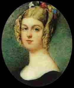
Augusta was the first Australian home of a remarkable woman, Georgiana Molloy (1805-43), daughter of a genteel Cumberland family who at 24 married the 48-year-old John 'Handsome Jack' Molloy, an army officer who had been wounded at Waterloo. In 1830, they migrated to Western Australia, settling in Augusta, where Georgiana became fascinated with the botanical wonders of the new land. In 1832, she wrote home to her sister, 'I am sitting in the Verandah surrounded by my little flower garden of British, Cape and Australian flowers pouring forth their odour... The native flowers are exceedingly small but beautiful in colour...' Georgiana became the first to study the colony's native flowers with any seriousness and began to send back to England both seeds and pressed plants. Her letters to English botanist James Lindley provided long and informative descriptions of the region's flora, and as a collector she rivalled the greatest European scientists of the time. In 1839 the Molloys moved to Busselton and established a property called Fair Lawn with an exquisite garden. She often went into the bush, which she described as being in 'the most delightful states of existence,' taking along local Aborigines for guidance and as companions. Georgiana died in childbirth, aged 37, deeply mourned by the scientific community. Her surviving children went on to marry leading figures in Western Australian society. Her story is the basis for many books, including Alexandra Hasluck's Portrait with Background: a Life of Georgiana Molloy (1955).
From Augusta, you can travel east via route 10 through timber country to Nannup (population 522); here route 10 becomes the Vasse Highway south to Pemberton (population 995), another timber town famous for its karri forests and high-quality woodcraft centres. Tourist information: Pemberton Visitors Centre, Brockman Street, 08 9776 1133. Here you can also ride the Pemberton Tramway (t 08 9776 1322; departures Mon.-Sat. at 19.45 and 14.00, duration 1 3/4 hrs.; fares adults $28, children $14), a replica 1907 tram that travels through the impressive karri and marri forests. 3km along the 18km road east from Pemberton to connect with Highway 1, is the Gloucester Tree, touted as the world's tallest fire-lookout tree-you can make the 61m climb along a rather harrowing set of steps, after which you receive a certificate for bravery. This tree gives some indication of the magnificence of the karri, the world's third largest after the California sequoia and the Australian mountain ash. Their leaves are two different colours, and their bark changes from orange-yellow to grey-white when old.
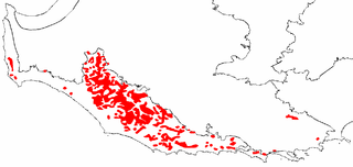
Map of southern Western Australia showing the distribution of the karri forests (Eucalyptus diversicolor)
The drive along the South Western Highway, as route 1 is called here, passes through impressive Tall Timber country with turn-offs to many national parks, all of them awe-inspiring displays of enormous karri forests and spectacular waterfalls. More detailed information about the parks is available from the National Parks website and at the Pemberton or Manjimup tourist offices.
Western Australian writer and socialist Katharine Susannah Prichard set her novel of timber-workers, Working Bullocks (1926), in this region. If coming from Perth, you may join the South Western Highway at Bunbury to travel down to the southern coast at Walpole, in which case you will pass through (36km south of Bunbury) Donnybrook (population 1635), settled by Irish in 1842 and now known for its apple orchards. Tourist information: Old Railway Station, t 08 9731 1720). The railway station in town on Turner Street is the site of a small transport museum.
The next major spot on the road south is Bridgetown (population 2123), 57km from Donnybrook. Bridgetown is the administrative centre of the region, situated on the Blackwood River at the junction of the South Western and Brockman Highways. It is frequently described as 'the prettiest country in the state'. Tourist information: Hampton Street, t 08 9761 1740. Also on Hampton Street is 'Bridgedale' a National Trust property. The house is not open for visitors though the grounds are. It was the first substantial house in the region, built by pastoralist John Blechynden in 1862. Also in the area are the Donnelly Timber Mill Museum at the Donnelly River Settlement 26km south-west of Bridgetown; and the Geegelup Heritage Trail, a 52km tourist drive through the Bridgetown-Greenbushes area, highlighting historic buildings and locations. A brochure of the trail is available from the Bridgetown tourist centre.
A further 37km on the South Western Highway brings you to Manjimup (population 4353), called 'the Gateway to Tall Timber Country'. Manjimup Tourist Bureau is on the corner of Rose and Edwards Street(t 08 9771 1831; open 9.00-17.00). The town is the region's commercial centre, and clearly demonstrates the importance of the timber industry here. Most of the walking tracks and picnic spots in the area centre on stands of hundred-year-old trees of karri or jarrah, such as the King Jarrah Tree, 4km northeast of Manjimup on Perup Road; it is believed to be 600 years old. Also in town is the Manjimup Regional Timber Park. The tourist centre is open daily and has an impressive visitor's centre highlighting the history of the timber industry here. (You will not find much about the great controversies and environmental struggles surrounding the destruction and subsequent preservation of these forests!) A further 15km south on the highway is the junction with Highway 1, which is 16km from
Pemberton to the west.
It is 103km from the junction with Highway 1 to Walpole on the so-called 'Rainbow Coast'; the coastline here is a mixture of sheltered inlets and rugged headlands on the Southern Ocean, and has recently become home for retirees and craftspeople, as well as a newly developing wine-growing region.
From Walpole, the highway continues east 120km to Albany, passing through the pleasant town of Denmark on the Denmark River. The area is filled with scenic drives, with turn-offs to rocky beaches which are ideal locations for bushwalking and picnics. Between Walpole and Denmark is Walpole-Nornalup National Park (t 08 9840 1027), 13,354 ha of enormous trees and rushing rivers. Trees include karri, jarrah, and tingle, and the walks through these forests are particularly impressive in the park's Valley of the Giants. Spectacular coastal scenery can also be reached in the park. It is important to note that Denmark is only 414km southeast of Perth, making the district a very accessible holiday destination for most Western Australians, and therefore crowded during school holidays and the summer.
Albany
Albany (population 27,000) is on King George Sound, which was named by British explorer George Vancouver when he passed by in 1791. Tourist information: Old Railway Station, Proudlove Parade; t 08 6820 3700.
History
It is this section of the southern coastline which first appeared on early Dutch maps and inspired Jonathan Swift to locate the island of Houyhnhnms in Gulliver's Travels (1726) off this mainland. The town itself was the site in 1826 of Major Lockyer's short-lived penal colony. The town's continued existence was due to whaling after the 1840s and as a coaling station for steamers bound for Europe after the 1850s. Until Fremantle became a viable port in the 1890s, Albany was the main Australian port between England and Sydney. It was the staging area for the Australian Light Horse regiment destined for Gallipoli in 1914. Until agricultural improvement in the 1950s and the rise in popularity of wines since the 1980s, much of the area's economy depended upon lumbering the breathtaking karri and jarrah trees that grow here. Conservation efforts, a more rational approach to governmental subsidies for the industry, and the simple scarcity of the stands of trees has seen their off-plantation harvesting begin to wane. The town is now one of the fastest-growing in the state, advertised as a great tourist destination without the tourist traps.
The southern right whales still frequent the area between July and September, and can be seen off the coast; tours to view the whales are also available from Albany Whale Tours (t 0422 441 484; departs Albany Frontwater Arena). Southeast of town, 21km on Frenchman Bay Road, is Whaleworld (t 08 9844 4021; open daily 09.00-17.00; admission adults $32, concession $29, children $12), located in the area's last whaling station, closed only in 1978-a reminder of how recently this barbaric operation was still sanctioned, and why the whale numbers here still need time to increase substantially. The museum includes a grisly film on whale-hunting and processing, as well as remnants of machinery and ships used in whaling operations.
Albany's tourist bureau (t 08 6820 3700, 9.00-17.00), in the old railway station on Proudlove Parade, can provide a walking tour of the city. Just
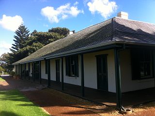 around the
corner on Stirling Terrace is a Tudor-style cabmen's shelter
of about 1910, from horse and buggy days, with a 1926
extension built as a women's rest room. Stirling Terrace also
includes many fine Victorian-period buildings, including the Old Gaol
(t 0457 329 944; open daily 10.00-16.00; admission adults $5,
concession and children $2.50), the surviving buildings of
which were erected in 1873. Opposite the gaol in an 1850s
building is the Albany
Residency Museum (1300 134 081; open Thurs.-Tues
11.00-16.00, Wed. 13.00-19.00; admission $5 donation), a good
historical museum with seafaring artefacts, Aboriginal relics,
and displays of flora and fauna. Next to the museum is a
full-scale replica of the brig Amity, Albany's 'founding ship'.
around the
corner on Stirling Terrace is a Tudor-style cabmen's shelter
of about 1910, from horse and buggy days, with a 1926
extension built as a women's rest room. Stirling Terrace also
includes many fine Victorian-period buildings, including the Old Gaol
(t 0457 329 944; open daily 10.00-16.00; admission adults $5,
concession and children $2.50), the surviving buildings of
which were erected in 1873. Opposite the gaol in an 1850s
building is the Albany
Residency Museum (1300 134 081; open Thurs.-Tues
11.00-16.00, Wed. 13.00-19.00; admission $5 donation), a good
historical museum with seafaring artefacts, Aboriginal relics,
and displays of flora and fauna. Next to the museum is a
full-scale replica of the brig Amity, Albany's 'founding ship'. The town also has several splendid 19C residences in attractive architectural styles. At 6 Cliff Way is 'Hillside', built in 1886 for Albert Young Hassell, parliamentarian and delegate to the Constitutional Convention of 1897. The house has two-storey verandahs with cast-iron lacework and Classical Revival details. Even more impressive is 'The Rocks', 182-8 Grey Street, overlooking the town and harbour. This large stone house was built in 1884 for Albany's first mayor, William Grylls Knight. During the 1920s, the house served as the summer residence of the Western Australian governor, thus its label as Government House/Cottage. Its lovely verandah and balcony surrounding the building is characteristic of much of Albany's best early architecture.
On York Street, the Church of St John the Evangelist, along with its Hall and Rectory, provides a good example of early stone architecture in the area; the church itself, with fine stained-glass windows and wrought-iron screen, was built in 1841-48, while the Hall of local brick was added in 1889.
The view from Mount Clarence-something of a scramble by foot starting at Grey Street East or a drive up from the hill's opposite side-overlooks the town and harbour. Also on the mountain is the Desert Mounted Corps Memorial, a bronze monument originally placed at Port Said, Egypt, to commemorate the Australian troops who sailed from Albany in 1914. Another casting of this monument, sculpted by Webb Gilbert, Paul Mountford, and Bertram Mackennal, is also erected on Anzac Parade in Canberra. Here the monument looks out to sea, where the troops would have last seen Australian soil before landing at Gallipoli.
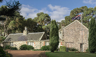 Albany's finest
demonstration of its heritage, called the Old Farm (t 08 9841
3735; open daily 10.00-16.00; admission $5 donation), was
government resident Richard Spencer's gentlemanly country
estate. This spectacularly well-maintained property was
repaired in the early 1960s by the National Trust and last
renovated in 1889 by then owner architect Francis Bird who
also named it. The original function of the property was as a
vegetable garden and maize farm, serving the military
detachment at King George Sound in 1827. The first government
resident was Dr Alexander Collie who built a cottage near the
garden in 1831. Sadly, the fittings Spencer brought for the
house and its extensions were largely lost to fire in 1870.
There is continued debate about whether the structure can be
considered the oldest house in Western Australia; it is
certainly the finest old structure, sitting in gardens which
include plants and trees from Spencer's seeds brought from
England.
Albany's finest
demonstration of its heritage, called the Old Farm (t 08 9841
3735; open daily 10.00-16.00; admission $5 donation), was
government resident Richard Spencer's gentlemanly country
estate. This spectacularly well-maintained property was
repaired in the early 1960s by the National Trust and last
renovated in 1889 by then owner architect Francis Bird who
also named it. The original function of the property was as a
vegetable garden and maize farm, serving the military
detachment at King George Sound in 1827. The first government
resident was Dr Alexander Collie who built a cottage near the
garden in 1831. Sadly, the fittings Spencer brought for the
house and its extensions were largely lost to fire in 1870.
There is continued debate about whether the structure can be
considered the oldest house in Western Australia; it is
certainly the finest old structure, sitting in gardens which
include plants and trees from Spencer's seeds brought from
England. Northeast of Albany (14km) in Mirambeena Park, Down Road, is Mount Romance (t 08 9845 6888; open daily 09.00-17.00), described as a 'boutique factory' and perfumery, which uses native plants and emu oil to produce unique herbal products. Traditionally, emu oil has been used for its medicinal properties, especially for arthritis. They are also known for their sandlewood; a moving sound and aroma experience can be had Wed.-Fri. 10.30 and 12.30, Sat. and Sun. 10.30, 12.30, and 24.00 ($24, 08 9845 6817). The factory is a quite fascinating experience, with unique perfumes available.
Directly north of Albany c 40km is Porongorup National Park (t 08 9842 4500; open Mon.-Fri. 8.30-16.30), filled with wooded granite formations believed by geologists to be among the oldest rocks in the world. These peaks, some as high as 600m, have distinctive shapes and consequently descriptive names such as Castle Rock, Sheep's Head, and Devil's Slide. The park has a variety of picnic spots and bushwalking opportunities, from the easily accessible Tree in the Rock, a 5-minute walk from the northern entrance, to rugged all-day climbs of the peaks. Camping in the park is prohibited but reasonable accommodation is available around the northern entrance.
This region also has a number of excellent wineries (both red and white wines), and each March the Porongorup Wine Festival is a festive event. Information on Great Southern Wineries tours is available at the tourist offices in nearby Mount Barker or in Albany.
The natural environment around Albany is the real attraction for holiday- makers. On the east side of town, the protected waters of King George Sound offer excellent calm beaches, such as Middleton Beach, 4km east of Albany.
To the southwest of Albany (c 10km) is Torndirrup National Park (t 08 9842 4500), around Princess Royal Harbour and south to Frenchmans Bay and the Flinders Peninsula. This park includes some of the most scenic landscape along this windswept coast, with awe-inspiring glimpses of the fearsome waves of the Southern Ocean crashing against the granite rocks. Jimmy Newhill's Harbour in the park offers calmer waters, and the entire region is famous for its brilliant displays of wildflowers. Take extra care when walking around the coastal rocks, as accidents are frequent when the waves are high.
Esperance to Norseman
If you have been driving across the Nullarbor from South Australia to Western Australia, you will be overjoyed to reach Norseman (population 520); it is the westernmost town on the highway across the Nullarbor Plain. The nearest town to the east of any size is Ceduna, South Australia, 1200km away. Norseman was founded on gold and was named after a horse that pawed the ground here and unearthed the first specimen of ore. The Jimerlana Pike nearby is one of the oldest geological features in the world. Tourist information: Robert Street, t 08 9039 1071.
Esperance
If you have travelled east from Albany on route 1, the end of the road is Esperance (population 11,700), with 480km of fairly boring road between the two points. At Esperance, the road heads north to Norseman and then on to Kalgoorlie- Boulder. While the town's name does indeed sound hopeful, the actual settlement is largely a port and service centre for the agricultural region around it, although the coastal and harbour beaches around the town are spectacular. Tourist information: Dempster Street; t 08 9083 1555).
History
The bay on which the town sits was first discovered by Dutch navigator Peter Nuyts in 1627, although the area was not mapped until 1792, when a French expedition in the ships L'Esperance and La Recherche entered the area and gave names to the surrounding geographical features. The first permanent settlers arrived in 1863, although explorer Edward John Eyre had passed through this spot on his overland journey from Adelaide in 1841. The town really came into its own during the 1890s gold rush; only in the 1950s did agriculturalists discover that the addition of minerals to the poor soil could transform the area into fertile farmland.
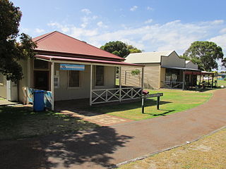 The town has a good Municipal
Museum (t 08 9071 1579; open daily 13.30-16.30), between
Dempster Street and the Esplanade, housing remnants of Skylab,
the US space station launched in 1973 that crashed to earth
over Esperance in 1979. Next to the museum is an
arts-and-crafts Museum Village. On Windich Street is the
town's excellent Public Library with a comprehensive
collection of books about Esperance and the surrounding
landscape.
The town has a good Municipal
Museum (t 08 9071 1579; open daily 13.30-16.30), between
Dempster Street and the Esplanade, housing remnants of Skylab,
the US space station launched in 1973 that crashed to earth
over Esperance in 1979. Next to the museum is an
arts-and-crafts Museum Village. On Windich Street is the
town's excellent Public Library with a comprehensive
collection of books about Esperance and the surrounding
landscape. From the middle of town begins a 36km Scenic Loop Road, signposted as Tourist Way 358, which encompasses several interesting vistas, as well as the popular Pink Lake, so-called because a salt-tolerant algae actually colours the waters pink. In his poem, 'Cycling in the Lake Country', contemporary poet Les Murray writes about it:
I reached a final lake
cupped in rough talcum.
Soft facepowder bloom made all the hanging country
fairly peach.
The other highlight along the drive is a swim at the idyllic and sheltered Twilight Cove.
Just outside town to the east (56km) is Cape Le Grand National Park, extending between 20km and 60km from Esperance and filled with beautiful white-sand beaches and brilliant blue bays. Off the coast is the Archipelago of the Recherche, a scattered array of some 100 small islands, many of them home to colonies of seals, feral goats and penguins. Tour cruises of all sorts are available through the Esperance tourist office. Further along this stretch is the less accessible Cape Arid National Park, the real starting point of the Great Australian Bight. For information about these and other national parks, contact the Le Grand National Park office in Esperance, t 08 9083 2100.
WARNING. If you are travelling off the major roads, please pay attention to your maps. Ask at each juncture along the way about the advisability of your route. Pay attention to distances, road types and provisions (especially water). Let someone know where you are going, what your route is and when you expect to arrive. Let them know when you do arrive. Stay with your vehicle if it breaks down. If you are absolutely certain of how far along the road you have to walk to get help, leave a note describing your direction of travel and the time.
Kalgoorlie-Boulder
From Esperance, Norseman is 204km north. From here it is about two hours north to another, more famous gold-mining region in Kalgoorlie-Boulder (population 28,100). Tourist information: 250 Hannan Street; t 08 9021 1966; open Mon.-Fri. 8.30-17.00, weekdays 9.00-14.00. 600km east of Perth, it completes a rectangle of roads in the southern section of the state. The Prospector train service from Perth to Kalgoorlie runs 10 times a week, stopping at the main railway station. The India-Pacific train also comes into town twice a week en route to Perth from Adelaide and returning to the eastern states; travellers may break their journey here if they wish to wait until the next train comes in two or three days.
Paddy Hannan, an itinerant prospector, discovered gold in the area in 1893. The resulting town was briefly known as Hannan's Find until residents chose the present name, from the Aboriginal 'galgurlie', referring to a local species of scrub acacia or wild pear. The region is extremely dry; water, transported by the railroad, routinely sold on the gold fields for as much as 2 shillings a gallon. Eventually, a 563km-long pipeline from the Mundaring Weir near Perth was built from designs by engineer C.Y. O'Connor, who also constructed the Fremantle Harbour. By the time water arrived, the Golden Mile at Boulder was legitimately famous as the world's richest gold-bearing reef.
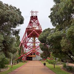 Museums in town depict
the gold rush (Museum of the Gold fields, next to the British
Arms Hotel, Hannan Street; t 08 9021 8533; open daily
10.00-15.00), mining technology and mineralogy (the School
of Mines Mineral Museum; t 08 9088 6002; open weekdays
08.30-12.30, closed school holidays) and a functioning mine (Hannans North Tourist Mine;
t 08 9022 1664; open daily 09.00-15.30; open Sun.-Fri
9.00-15.30; admission adults 413.00, concession $9.50,
children $7.00). Especially impressive in Kalgoorlie is the
Hannan Street precinct, all of which is heritage-listed.
Exceptional wealth from the gold mines in the late 1890s saw
the erection of many substantial public buildings along this
street, all the more imposing when one considers their utter
isolation in the dry and flat countryside. These buildings
include the Kalgoorlie Town Hall on the corner of Hannan and
Wilson Streets (open weekdays 09.00-16.30), completed in 1908
by J.W.S. James, with an enormous staircase, chandeliers, and
painted pressed metal ceiling. A bronze statue of Paddy Hannan
also stands in the hall. At 119-127 Hannan Street is the
Kalgoorlie Miner Building, erected in 1900 as the newspaper
office and printers of the Kalgoorlie Miner, still published
here.
Museums in town depict
the gold rush (Museum of the Gold fields, next to the British
Arms Hotel, Hannan Street; t 08 9021 8533; open daily
10.00-15.00), mining technology and mineralogy (the School
of Mines Mineral Museum; t 08 9088 6002; open weekdays
08.30-12.30, closed school holidays) and a functioning mine (Hannans North Tourist Mine;
t 08 9022 1664; open daily 09.00-15.30; open Sun.-Fri
9.00-15.30; admission adults 413.00, concession $9.50,
children $7.00). Especially impressive in Kalgoorlie is the
Hannan Street precinct, all of which is heritage-listed.
Exceptional wealth from the gold mines in the late 1890s saw
the erection of many substantial public buildings along this
street, all the more imposing when one considers their utter
isolation in the dry and flat countryside. These buildings
include the Kalgoorlie Town Hall on the corner of Hannan and
Wilson Streets (open weekdays 09.00-16.30), completed in 1908
by J.W.S. James, with an enormous staircase, chandeliers, and
painted pressed metal ceiling. A bronze statue of Paddy Hannan
also stands in the hall. At 119-127 Hannan Street is the
Kalgoorlie Miner Building, erected in 1900 as the newspaper
office and printers of the Kalgoorlie Miner, still published
here.Despite the water pipeline not reaching Kalgoorlie-Boulder until 1903, most of the town's architecture dates from the late 1890s. The town of Boulder, now twinned officially with its more famous neighbour Kalgoorlie, also has on Burt Street an interesting collection of Victorian buildings. Boulder's Town Hall, on the corner of Burt and Brookman Streets, opened four months after Kalgoorlie's did, with week-long celebrations. Its stage saw performances by Dame Nellie Melba, and still has its original drop curtain by Philip Goatcher, the only one of its kind left. In keeping with its status as a genuine gold-rich boom-town, the many substantial buildings now seem out of proportion to the town's present population, although a certain Las-Vegas-style exuberance still permeates the atmosphere. Citizens remain proud of their peculiar isolation and their rugged lack of sophistication.
The open areas within the town's borders are often marked by grey mine tailing, known locally as 'slimes', and numerous abandoned shafts. Caution is needed when walking away from frequented paths; these shafts are not always posted and are not normally fenced.
Some 7km to the north of Kalgoorlie is the site of a tin shed that is one of Western Australia's most famous institutions, the state's only (legal) 'school' for 'two-up', Australia's most traditional form of gambling. From Menzies Road, follow the signs that say 'two up' to reach this 'casino'; gambling traditionally commenced every day at 16.30 except on fortnightly pay days. Now the school is run as a charity every Sunday. The game starts at 13.00, but a practice session begins at 12.30 using play money.
Gambling -- Two-up
The real exciting game Two-up is played in small towns on Anzac Day. Observers bet against one another on the outcome of two coins tossed in the air off a paddle.
Two-up, sometimes referred to as Australia's 'national game', is also called "swy", from the German zwei. Though rarely heard now, this term was used extensively until anti-German sentiment set in with the First World War. The game has taken on legendary status in the folklore of Australia. Its significance in Australian life is evident in legions of stories dating from convict times; indeed, it was certainly played by members of the First Fleet. In the classic Australian story, C.J. Dennis's songs of a "Sentimental Bloke" (1915), and in the 1919 film of the same name, two-up plays a major part:
Dymphna Cusack's novel Come In, Spinner (1951) derives its title from a two-up term.
One of the most enthusiastic descriptions, centred on the multitude of slang originating from the game, is given in Sidney J. Baker's excellent book The Australian Language (1966), in which he devotes eight pages to the traditions, history, and terminology of the game. The 'rules' are ludicrously simple, at least at first glance: it involves two coins tossed in the air, with bets placed on landing heads, tails, or mixed. The rituals that have developed around this version of pitch-and-toss, however, are as complex as a ceremonial ritual and say much about traditional Australian attitudes. Indeed, legend has it that during the famed Battle of Gallipoli in the First World War, the Turks refrained from bombing a group of Anzacs playing two-up, since it appeared from all their bowing and stooping that a religious ceremony was taking place. While the game is still considered illegal when played outside casinos, common tradition still dictates that no one can be arrested for playing two-up on Anzac Day.
The game is played in 'schools'; these can be small informal groups or well-organised and long-established clubs. The most famous was Thomas' sor 'Thommos's in Sydney, where the Thomas family ran the school for more than 50 years. Thommos's reputation rested on its scrupulous honesty and supervision, something decidedly lacking in many two-up matches. In a government probe into organised gambling in 1951, the New South Wales police determined that Thommos alone turned over thousands of pounds a night and had 30 permanent employees earning at least £600 a week. Another famous school, and one steeped in outback mythology, is this tin shed in Kalgoorlie. The Western Australian government made the school legal in 1983. Today the game is played, amidst the glamour and glitz of blackjack, craps, and roulette, at the casinos, although some of its cultural ambience seems to have disappeared in such predictable surroundings.
Coastal route north to the Northern Territory
The coastal highway, no. 1, north from Perth passes through Geraldton, Carnarvon, along the Pilbara to Port Hedland, skirting the Great Sandy Desert to Broome and below the Kimberley region to Kununurra and the Northern Territory. The only unsealed section of Highway 1, which encircles Australia, occurs between Fitzroy Crossing and Halls Creek, in the remote Kimberley region of the state. The other route north is no. 95, the Great Northern Highway, which takes an inland course all the way to Port Hedland, where it connects with Highway 1.
On the Great Northern Highway, 131km north of Perth, is New Norcia (tourist information is through the Benedictine Monastery (08 9654 8056), an intriguing Benedictine community,
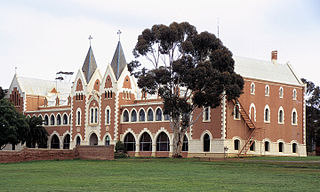 established
in 1846 by Spanish monk Rosendo Salvado. Salvado (see
biography above) had been recruited in Italy by Western
Australian bishop John Brady to serve as a missionary to the
Aboriginal groups in the region. Salvado set about learning
the languages of the Yuet and Balardong groups, producing
significant early ethnographic studies. These studies have
been published as The Salvado Memoirs (1851; 1977), expressing
sympathetic and well-informed assessments of Aboriginal
spirituality and customs. Salvado established the mission here
as an efficient farm, and returned to Europe to recruit more
monks in the 1850s. In 1867 he became abbot of the monastic
community for life.
established
in 1846 by Spanish monk Rosendo Salvado. Salvado (see
biography above) had been recruited in Italy by Western
Australian bishop John Brady to serve as a missionary to the
Aboriginal groups in the region. Salvado set about learning
the languages of the Yuet and Balardong groups, producing
significant early ethnographic studies. These studies have
been published as The Salvado Memoirs (1851; 1977), expressing
sympathetic and well-informed assessments of Aboriginal
spirituality and customs. Salvado established the mission here
as an efficient farm, and returned to Europe to recruit more
monks in the 1850s. In 1867 he became abbot of the monastic
community for life. The remarkable Benedictine Monastery buildings, some of which are constructed in a Spanish colonial style unlike others in Australia, are planned axially, with cemetery, pro-cathedral and monastery placed on an east-west axis, and orphanages and school on a north-south axis, roughly in the form of a cross. The most ornate buildings are St Gertrude's Residence for Girls and St Ildephonsus' Residence for Boys, complete with Moorish minarets.
The Monastery is still a functioning one, with a few resident monks; the community offers weekend retreats to the public (t 08 9654 8018). The community's tourist office (t 08 9654 8020) is in a complex with general store, hotel and post office. Tours depart daily at 11.00 and 13.30 and last about two hours. Also open to the public is an impressive museum and art gallery (t. 08 9654 8056; open 9.30-16.30, admission adults $12.50, concession $10.00, children $7.50) with a substantial collection of religious art including paintings by Spanish and Italian artists, gifts from the Queen of Spain, and Australian art. The monastery's library contains many rare books, including 2000 volumes dated before 1800 and the oldest one from 1508.
Geraldton
Alternately, leaving Perth on Highway 1, the first town of any size north of the city is Geraldton (population 25,000), some 425km away. Tourist information: t 08 9956 6670.
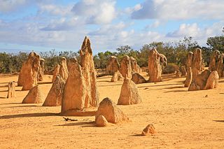 To break the trip,
consider stopping at Nambung
National Park, Particularly in September and October
when the wildflowers are blossoming. The Park also has a
desert area with pinnacles, an interesting geolgical feature.
The trail head for a 45 minute walk through them is from the
Discovery Centre's parking lot.
To break the trip,
consider stopping at Nambung
National Park, Particularly in September and October
when the wildflowers are blossoming. The Park also has a
desert area with pinnacles, an interesting geolgical feature.
The trail head for a 45 minute walk through them is from the
Discovery Centre's parking lot. Geraldton, an agricultural and fishing centre (lobster season is from summer through autumn), dates from the 1850s after explorer Lieutenant George Grey praised the area to the authorities in 1841. Author Randolph Stowe described the town as 'clean and tidy and pretty, the iron roofs of the houses small and near, the harbour blue as New Guinea butterflies, the dunes to the south blinding white against the sea' (The Merry-go-round in the Sea, 1965). The town has long been a popular holiday destination, aided by its famous climate: an average year-round temperature of 28ºC and eight hours of sunshine a day. Long sandy beaches and great splashes of wildflowers in the surrounding countryside add to its popularity with holidaymakers; be sure to book well ahead if travelling here during school or summer holidays.
Nearly all the early descriptions mention displaced Aborigines living on its fringe. The cathedral, dedicated to St Francis Xavier, was designed by Monsignor John Cyril Hawes and built between 1916 and 1938. Trained in London, Hawes designed a number of churches and buildings in the diocese. In 1939 he left Australia to become a hermit in the Caribbean. The cathedral is a handsome building of functional appearance largely without exterior ornament. The interior features include an octagonal dome, arches, circular windows and pleasant natural light.
The Maritime Museum (t 08 9431 8393; open daily 9.30-15.00; $5.00 donation), on Marine Terrace and one section of two buildings comprising the Geraldton Museum (the other side is artefacts and memorabilia) has displays describing the shipwreck Batavia. One of several Dutch East India Company ships wrecked on Australia's east coast during the 17C, her crew were marooned on the Houtman Abrolhos Islands 60km offshore. A party made the trip to Batavia (now Jakarta) in an open boat and sent a rescue ship to the crew's aid. In the intervening three months a mutiny occurred during which more than 120 of the crew were murdered. The leaders of the mutiny were hanged and two of their followers were abandoned on the coast near Geraldton. The islands offshore are accessible by boat or plane, and tours can be arranged through the tourist office; they offer excellent opportunities for snorkelling and diving. Overnight visits are not allowed.
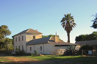 Also in the area, 24km
south of Geraldton, is Greenough
(pronounced 'grenuf') Village (t 08 926 1084; open Mon. - Sat.
9-16.00, Sun. 8-16; adults $8.00, concession $5.00, children
under 5 free), a National Trust presentation of eleven 1880s
buildings, eight of which are furnished from the late 19C. A
number of calamities -- cyclones, wheat rust, flooding, the
discovery of gold, and ubanization among them -- led to the
near abandonment of the town. At one point on the
Anglican and Catholic churches and the Hampton Arms Hotel were
the only public venues in town. Crossing the Greenough
River is the McCartney Road Bridge, built by convict labour in
the 1860s. Natural settings in the vicinity of Geraldton
include the Murchison River, which cuts a spectacular and
rugged gorge in the Kalbarri National Park, some 186,000 ha of
interesting geological features.
Also in the area, 24km
south of Geraldton, is Greenough
(pronounced 'grenuf') Village (t 08 926 1084; open Mon. - Sat.
9-16.00, Sun. 8-16; adults $8.00, concession $5.00, children
under 5 free), a National Trust presentation of eleven 1880s
buildings, eight of which are furnished from the late 19C. A
number of calamities -- cyclones, wheat rust, flooding, the
discovery of gold, and ubanization among them -- led to the
near abandonment of the town. At one point on the
Anglican and Catholic churches and the Hampton Arms Hotel were
the only public venues in town. Crossing the Greenough
River is the McCartney Road Bridge, built by convict labour in
the 1860s. Natural settings in the vicinity of Geraldton
include the Murchison River, which cuts a spectacular and
rugged gorge in the Kalbarri National Park, some 186,000 ha of
interesting geological features. The popular holiday resort of Kilbarri sits at the mouth of the river, and is the best place to begin tours of the national park. Tourist information: Grey Street; t 08 9937 1104. The area is especially renowned for the more than 500 wildflower species that bloom here each year. Just south of the town at Wittecarra Creek, a cairn marks the spot believed to be where the first white men walked on the Australian mainland: two mutineering sailors exiled from the Dutch ship Batavia in 1629. Back on Highway 1, the road between Geraldton and Carnarvon-all 481km of it-passes through nearly all of the local floral zones. The winter agriculture belt ends in low, scrubby mallee around the Kalbarri National Park. Near the Overlander Roadhouse varieties of daisies form the understorey. Once on the approach to Carnarvon, arid hearty salt and blue bush alternate with acacia. This vegetation continues along the fringe of the Great Sandy Desert.
Shark Bay
From Kalbarri, 228km north is the turn-off at Overlander Roadhouse, for Shark Bay, another of Australia's World Heritage-listed sites. Comprised of two peninsulas, this intriguing geographical feature is now a 22,000 sq km national park. The small settlement of Denham (population 1100) in the park is considered the westernmost town in Australia and is the main centre for the region. The Shark Bay Tourism, a members visitor association, can provide great quantities of tourist information.
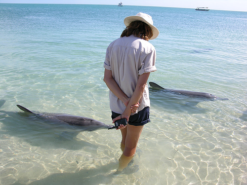 As any visitor to
Australia will no doubt learn, the great tourist attraction at
Shark Bay is Monkey Mia, a beach where friendly bottlenose
dolphins come voluntarily into the shallows and can be
hand-fed and touched by visitors. The
information centre here is open daily, 08.30-16.30, t 08
9948 1366. While enthusiastic throngs have somewhat
overwhelmed the beach in the last few years and are kept under
control by harried park rangers, the experience of seeing the
dolphins can still be an enjoyable one, if a bit
over-advertised (dolphins do this in other less crowded
locations along the coast, especially at Bunbury). Visitors
should note that Monkey Mia is 850km from Perth and plan their
visit accordingly!
As any visitor to
Australia will no doubt learn, the great tourist attraction at
Shark Bay is Monkey Mia, a beach where friendly bottlenose
dolphins come voluntarily into the shallows and can be
hand-fed and touched by visitors. The
information centre here is open daily, 08.30-16.30, t 08
9948 1366. While enthusiastic throngs have somewhat
overwhelmed the beach in the last few years and are kept under
control by harried park rangers, the experience of seeing the
dolphins can still be an enjoyable one, if a bit
over-advertised (dolphins do this in other less crowded
locations along the coast, especially at Bunbury). Visitors
should note that Monkey Mia is 850km from Perth and plan their
visit accordingly! The park is also home to some 10,000 dugongs, green turtles, manta rays, whales and many species of sharks. The area also includes ancient rock formations known as stromatolites, built over hundreds of years by blue-green algae. Some of these stromatolites were formed up to three billion years ago, and some at Shark Bay are known to have formed over a period of 1000 years or more.
Monkey Mia borders the François Peron National Park (t 08 9948 2226), proclaimed a national park in 1990 and named for the French naturalist who visited here in 1801 as part of the Baudin voyage. The most striking feature of this 40 million ha park is the clash of brilliant red sand dunes with the bright blue Indian Ocean. Camping areas with limited facilities are available in the park. An old homestead in the middle of the park, built in the late 19C when the land was a sheep station, is accessible; to the north of the site, access is by four-wheel-drive only.
This stretch of coastline also includes Shell Beach, 110km of shoreline filled with tiny shells. On the western side of Shark Bay is Dirk Hartog Island, where Dutch explorer Dirck Hartog landed in 1616. It was here that he nailed an inscribed plate, later taken by a Dutch visitor and now on display in the Rijksmuseum in Amsterdam. Another Dutch explorer, Willem de Vlamingh, landed in Shark Bay in 1697. This area also had an early pearling industry and a mixed population including Malays and Chinese; today, it is world-famous for its superb fishing.
Carnarvon (population 6600), a further 480km north, sits at the mouth of the Gascoyne River. Known for banana plantations and marine crayfish (harvested April to October), the town dates from the 1880s. Novelist Nene Gare, who lived here after the Second World War, wrote of the town in Green Gold (1963): 'The wide main streets were made to take a double team of camels pulling twelve-foot drays shod with big iron wheels. There had to be room for the Afghan drivers to take a round turn, with the result that modern traffic finds itself with parking space in the middle of the road as well as at both sides.' Tourist information: Robinson Street; t 08 9941 1146.
Hibiscus and bougainvillea flourish in its tropical climate. The area has excellent fishing and crabbing, good beaches and curious blowholes and one of the continent's best place-names in Useless Loop. The towns on the northeast corner of the state are devoted to marine shipping and deep sea sport fishing around the Dampier Archipelago. Exmouth (population 3058) is a naval station founded only in 1967, and severely damaged by Cyclone Vance in March 1999; Onslow, one of the few towns in Australia bombed in the Second World War, had to be relocated due to cyclones. Dampier is a deepwater port loading iron ore. Roebourne, the area's oldest town, has a number of stone buildings from the 1880s and 1890s. Port Hedland ships handle high tonnage of natural resources.
Of greatest interest at Exmouth and the peninsula is Cape Range National Park, 39km west of the town (t 08 9949 2808). The Milyering Visitor Centre (open daily 10.00-16.00), 52km southwest of Exmouth, is the best place to begin a visit to the park; it has excellent displays and detailed information about the many walking trails and interesting sites in the park, and a particularly enthusiastic staff of rangers. Of special interest in the park, accessible on walking tracks, are Yardie Creek Gorge, with bands of fossil-bearing limestone contrasting with the brilliantly aqua blue waters of Yardie Creek; and Charles Knife Canyon, whose views are frequently described as 'indescribable'.
Adjacent to Cape Range Park is Ningaloo Marine Park, on Ningaloo Reef, Western Australia's largest and most accessible coral reef (its extension is from latitude 21º40' to 23º15' and longitude 113º35' to 114º10'-some 250km from North West Cape towards Cape Farquhar). The lagoon formed between the reef and the shore is up to 15m deep with coral and algae colonies supported on a limestone base. Ningaloo is the world's largest coral reef so close to a continental landmass; it offers fantastic snorkelling and fishing possibilities. From June to November, humpback whales from Antartica travel up this part of the coastline to breed; from March to June, whale sharks descend on the reef to eat coral spawn, providing an unprecedented opportunity to view these enormous creatures. Whale-watching cruises can be arranged through the visitor's centre.
Perhaps more interesting than iron ore shipping, the area has a number of Aboriginal rock art sites. The most noteworthy are in the valleys southwest of Dampier, on Depuch Island, in the Millstream Chichester National Park (t 08 9144 1060) about 80km inland to the south from Roeburne, on the Burrup Peninsula and directly south of Port Hedland around Abydos and Woodstock.
Visiting rock art sites
PLEASE CHECK WITH LOCAL ABORIGINAL GROUPS OR THROUGH TOURIST OFFICES BEFORE ATTEMPTING TO VISIT ANY ROCK ART SITES.
Approaching these sites requires some delicacy. Control over them has only recently been ceded to the Western Australian Aboriginal communities. The previous stewards of the sites at the Western Australian Museum implied that they were not open to unescorted visitors. Although some discussion of access has begun in the Aboriginal communities, arrangements for routine interpreted access proceeds slowly. The brief descriptions of the areas around Dampier and Port Hedland may alert tourists to avail themselves of access should the Kariyarra or Martuthunira Aboriginal custodians elect to provide it; check with the tourist offices in Dampier or Port Hedland for the current status of the sites and accessibility policy. The art is said to be on a par with that in the Hawkesbury near Sydney and that in the adjacent Kimberley.
The engravings at the Dampier Art Site are in valleys southeast of the town. At Skew Valley a well-known group of petroglyphs include a crab, two eggs, and an ibis with a snake in its mouth. In Gumtree and Kangaroo valleys the images are again of animals and were produced by abrading grooves. Within the Hunter Valley, the Altar Site has bats, humans and a large boomerang engraved on an outcrop of stone. Happy Valley has a variety of motifs, including a Tasmanian Tiger. The associated cultural artefacts have been radio carbon-dated from 2300 to 6600 years ago.
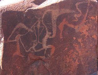 The Burrup Peninsula,
17km northeast of Dampier, has a dense concentration of rock
art sites also presenting a diversity of motifs and forms.
That at about 9km northeast of town has a number of panels on
which figures are portrayed climbing and gathering. These were
produced by pecking dots into the rock with a sharp stick or
other implement.
The Burrup Peninsula,
17km northeast of Dampier, has a dense concentration of rock
art sites also presenting a diversity of motifs and forms.
That at about 9km northeast of town has a number of panels on
which figures are portrayed climbing and gathering. These were
produced by pecking dots into the rock with a sharp stick or
other implement.Depuch Island sits 4km offshore between Roebourne and Port Hedland. The exposed basalt surfaces are red-brown or orange; beneath the surface they are a grey-green to yellow. The Ngarluma group call the variously sized figures 'mani'. Generally pecked, they depict thousands of figures and implements. The male and female figures on the surfaces erected at Hunters Pool on the island's northwest are described as impressive. The most recent figures relate to contemporary religion.
Accessible engravings around Port Hedland include some rays, turtles and a whale beside the BHP main gate on Two Mile Ridge.
The rock art sites on Abydos and Woodstock stations, about 150km south of Port Hedland off the Great Northern Highway, are of two sorts. The older (c 17,000 years ago) are usually abraded grooves on the horizontal brown granite boulders. The more recent are pecked and include human, part human and part animal, and a variety of animal representations. Most interesting are mythological figures with long narrow bodies, flexible arms and legs without elbows or knees, muzzled visages and exaggerated genitalia. Anthropologists surmise that the sites are part of women's rituals, in part because, being males, they could get only vague interpretative statements from the people living near the sites.
Incidentally, Marble Bar, 203km southeast of Port Hedland, is popularly known throughout Australia as having the continent's hottest and most inhospitable weather. This spot set a world record in the 1920s with temperatures over 37ºC (the old 100º Fahrenheit mark) for 160 consecutive days. Temperatures over 40ºC are quite common from October through March, and Marble Bar has reached as high as 50º C. Its wildflowers in late winter, on the other hand, make this town pretty and surprisingly well frequented. The town's name derives from the amazing bar of jasper crossing the Coongan River near town, with patterns resembling marble.
Traditional land holders here are the Martuthunira near Dampier and the Kariyarra near Port Hedland. Stockmen from this group were the first in the stockmen's strikes immediately after the Second World War. Aboriginal stockmen, essential for the running of the region's huge sheep stations, were for the most part working under near-slave conditions. When they finally walked off the job, it led to police intervention and harrassment. Eventual support by unionists and others brought some government concessions, but black stockmen never returned to the stations; they became instead leading activists in the 1960s civil rights campaigns. Further, people from this region were instrumental in the outstation movement in which land rights were secured for new settlements on traditional land. An instructive local story recounts that the wife from a sheep station moved with her children to the local Aboriginal camp to avoid the coarse gold miners when they descended upon her husband's station in the 1880s, underlining the complex and contradictory interactions between native and white settlers from the beginning.
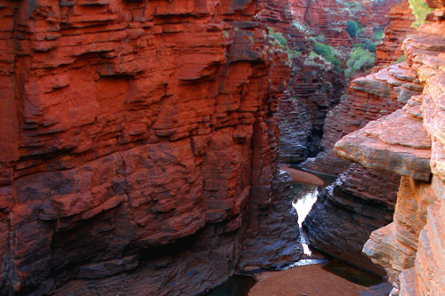
About 260km south of Port Hedland and 1375km north of Perth on the Great Northern Highway (route 95) is Munjina Roadhouse at the entrance to Karijini National Park (t 08 9189 8121), an enormous 650,000 ha reserve ecompassing the central section of the Hamersley Range of the Pilbara region. It is considered a 'must see' for its exquisite gorges, lookouts and waterfalls. It also contains Western Australia's highest peak, Mount Meharry (1245m); with four-wheel drive, one can drive to the peak. Entrance stations are at several points in all directions and an information centre is open in season near Yampire Gorge Road and Joffre Falls Road-both Yampire Gorge and Joffre Falls are worth visiting. As in so many other Western Australian parks, the wildflower display in Karijini in the spring is stunning.
Tourists are advised to avoid the odd little asbestos-ridden town of Wittenoom, on the northern edge of the park 18km west of Munjina Roadhouse. The town is marked with warning signs at the entrance, but inhabitants stubbornly refuse to leave the town.
Kimberley region
Across the Great Sandy Desert is the Kimberley region. Spoken of simply as the Kimberley, this region is a peninsular-shaped plateau of Early Proterozoic sandstone and occasional volcanic rock. Draining generally to the northwest, the area receives about 380mm rainfall in the southeast and up to 1300mm in its northwest, this largely as intermittent storms during December to April. While most tourists have preferred travelling in the north during the dry and sunny period, travellers increasingly recommend the still wet months of April and May. Tides can be substantial (as much as 12m) and frequently trap hapless fishermen off shore. The coastal areas are extremely rugged. Except at estuaries, cliffs rather than beaches are the rule.
The Great Northern Highway, still no. 1, more or less marks the furthest southern extent of the monsoonal rains, though sections of the road may be closed following heavy rains during the season. The cities from east to west include Derby, Fitzroy Crossing, Halls Creek, Wyndham and Kununurra.
Broome
Broome (population 8900) sits as a port on Roebuck Bay, a full 2200km north of Perth off the Great Northern Highway (Highway 95) or 2352km via North West Coastal Highway (route 1). Despite this tremendously distant location, with vast expanses of desert in between here and any centre of population, Broome is frequently voted Australia's favourite holiday destination, a result of its historic ambience and the efforts of English entrepreneur and philanthropist Alistair McAlpine. In the 1980s McAlpine took the town under his wing to renovate its unique environment. When McAlpine experienced financial difficulties, Broome's development, perhaps fortuitously, stopped just in time to prevent any theme parks or Club-Med-style overkill. There is an international airport, flights arrive from Indonesia as well as from the other Australian states.
Broome stages two important annual festivals: the Shinju Matsuri, the Festival of the Pearl, in late August/early September, a week-long celebration of the town's ethnic diversity and history, which includes the crowning of a Pearl Queen. Tourist information: on the corner of Bagot Road and Old Broome Road: t 08 9195 2200.
History
Broome sits on the land that pirate William Dampier sailed by in 1688; he landed in nearby King Sound, where he made his famous derogatory remarks about this entire western coastline (see above). Dampier returned in 1699 as captain of a vessel of the Royal Navy, the Roebuck, after which the bay is named. Some material evidence indicates that the Portuguese may also have travelled this far south in the 1500s. No permanent settlement began here until the 1880s, although the Djuelen group of Aborigines were traditional inhabitants, and fishermen from China, Indonesia and Malaysia have plied the waters around Broome for centuries.
Since the 1880s, Broome has been one of the most famous pearling ports in the world; it was named after Western Australia's governor in the 1890s, Frederick Broome. Pearling brought 'luggers' and divers from a variety of cultures, as many as 400 in the early 1900s; by 1910, Broome provided 80 per cent of the world's mother-of-pearl shell, the real source of profit for the industry, as long as most fashionable buttons were made from shell. Not surprisingly, Aboriginal trade in mother-of-pearl shell extended well into the interior, as far as Yuendumu and the desert regions of northern South Australia. Usually the shell was incised prior to trade and often the pattern was in-filled with fat and red ochre. The introduction of steel tools to work the shell saw this trade flourish in the early 20C. These shells are still prized, but the decorated shells are rarely produced now.
The town's ethnic mix and its frontier isolation made it for many years a rough-and-ready boom town, a source of imaginative romance for many writers and travellers. Novelist Henrietta Drake-Brockman lived here in the 1920s, and set her first historical romance, Blue North (1934), on the pearling grounds around Broome. Even realist writer Katharine Susannah Prichard waxed poetic about the place in Moon of Desire (1941): 'Always that rare blue-green of the bay, stretching up to the land, to gloat over ochre and terra-cotta cliffs to the north, and the lost grey-green line of the mangroves about the mouth of the creek.' Prichard's description highlights the most fascinating natural features of the town's location: the bright-blue waters of the bay contrasted against the white beaches, and the tropical trees and flowers of the community's gardens. One other natural characteristic is the extreme tidal range in the bay, which at the equinox twice a year can vary as much as 10m in a 12-hour cycle.
J.M. Harcourt's portrayal of the pearling industry's racial injustices is at the heart of his novel The Pearlers, (1933); and popular adventure writer Ion Idriess described the pearling trade in his Forty Fathoms Deep (1937). Arthur Upfield set one of his best 'Bony' mysteries, The Widows of Broome (1950), in the town, which at the end of the Second World War had a population of just 800. Indeed, Upfield chronicles the death of the old-fashioned pearl industry, a situation that nearly ended Broome. Recent pearl cultivation techniques have once again brought the town and pearling some economic stability, as Broome pearls begin to reappear on world markets.
 Broome continues to attract writers
and artists. Most recently, Broome native Jimmy Chi (b. 1948)
produced one of the first Aboriginal musicals, Bran Nue Dae, dealing
with political and cultural issues facing contemporary
Aborigines in Western Australia; the play was first performed
in 1990 at the Festival of Perth. Jimmy Chi, of Chinese and
Aboriginal background, is a good example of the ethnic
diversity characterising the current population of Broome:
Chinese, Aborigine, Anglo, and other Asian groups comprise one
of Australia's most multicultural communities. This diversity
is most cheerfully evident in the remainders of the town's
early vernacular architecture: a blend of British colonial
timber houses such as the teakwood Court House (1889), with
verandahs and ventilated rooms; some Asian-style building
conventions in the shops in Chinatown; and a few thoroughly
idiosyncratic touches, such as the mother-of-pearl chancery in
the 'Little White Church' Anglican church of 1903. The Broome
Tourist Information Centre is near the airport, and provides
good maps and 'Heritage Trails' tourist guides. An interesting
map to acquire is the Lurujarri Heritage Trail, prepared as a
Bicentennial Project by the town's Aboriginal community to
present, as the brochure says, 'the Song Cycle from Minarriny
to Yinara'. The trail leads along the Cable Beach coast north
for several kilometres from Gantheaume Point (Minyirr is its
Aboriginal name). It explains the spiritual significance to
the Aboriginal people of the various natural rock formations
and geological features.
Broome continues to attract writers
and artists. Most recently, Broome native Jimmy Chi (b. 1948)
produced one of the first Aboriginal musicals, Bran Nue Dae, dealing
with political and cultural issues facing contemporary
Aborigines in Western Australia; the play was first performed
in 1990 at the Festival of Perth. Jimmy Chi, of Chinese and
Aboriginal background, is a good example of the ethnic
diversity characterising the current population of Broome:
Chinese, Aborigine, Anglo, and other Asian groups comprise one
of Australia's most multicultural communities. This diversity
is most cheerfully evident in the remainders of the town's
early vernacular architecture: a blend of British colonial
timber houses such as the teakwood Court House (1889), with
verandahs and ventilated rooms; some Asian-style building
conventions in the shops in Chinatown; and a few thoroughly
idiosyncratic touches, such as the mother-of-pearl chancery in
the 'Little White Church' Anglican church of 1903. The Broome
Tourist Information Centre is near the airport, and provides
good maps and 'Heritage Trails' tourist guides. An interesting
map to acquire is the Lurujarri Heritage Trail, prepared as a
Bicentennial Project by the town's Aboriginal community to
present, as the brochure says, 'the Song Cycle from Minarriny
to Yinara'. The trail leads along the Cable Beach coast north
for several kilometres from Gantheaume Point (Minyirr is its
Aboriginal name). It explains the spiritual significance to
the Aboriginal people of the various natural rock formations
and geological features. At Gantheaume Point, the outgoing tide reveals giant dinosaur tracks, believed to be 130 million years old. Cement casts of the tracks are displayed near the warning light on the cliff. At the end of Cable Beach, at Cable Beach Road, is the Malcolm Douglas Crocodile Farm (t 08 9193 6580; open daily 14.00-17.00; admission adults $35.00, concession $30.00. children $20), one of the better examples of these attractions; it was founded by adventurer Malcolm Douglas, famed for his many nature documentaries about Australia. Since Broome is considered the westernmost limit for saltwater crocodiles, this is a good place to learn about them.
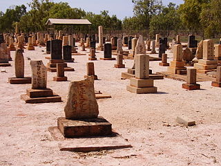 Back into town on
Cable Beach Road, some 3km, at the juncture of Frederick Drive
and Port Drive, is the old cemetery, most poignant for its
many Japanese graves, testament to the dangers of pearl
diving. More than 900 divers lost their lives searching for
these precious shells, many of them Japanese. Also in the
cemetery are sections for Chinese, Muslim, and Aboriginal
graves, a fascinating indication of Broome's unique cultural
heritage.
Back into town on
Cable Beach Road, some 3km, at the juncture of Frederick Drive
and Port Drive, is the old cemetery, most poignant for its
many Japanese graves, testament to the dangers of pearl
diving. More than 900 divers lost their lives searching for
these precious shells, many of them Japanese. Also in the
cemetery are sections for Chinese, Muslim, and Aboriginal
graves, a fascinating indication of Broome's unique cultural
heritage.The touring trail in town begins appropriately in Chinatown, a remnant of the enormous Chinese presence in the pearling industry here. Many of the original buildings have been reconstructed, with 'Oriental' touches even on the telephone booths. At the end of Dampier Terrace are old boat sheds, next to the dilapidated Streeter's Jetty which includes an old refurbished pearl 'lugger'. Dampier Terrace also houses some pearl dealers operating in original warehouses, and at the end of the block the old offices of the Broome News.
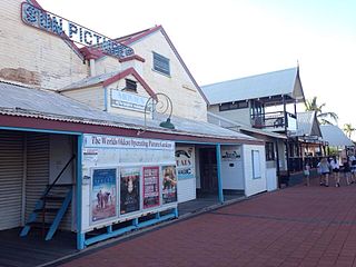 Of particular interest
in the neighbourhood is Sun Pictures, on Carnarvon Street,
between Short Street and Napier Terrace (t 08 9192 1677).
Opened in 1916 as an outdoor cinema, the 'theatre' is the
oldest 'picture garden' still in operation, with palm trees
swaying in the breeze behind the screen.
Of particular interest
in the neighbourhood is Sun Pictures, on Carnarvon Street,
between Short Street and Napier Terrace (t 08 9192 1677).
Opened in 1916 as an outdoor cinema, the 'theatre' is the
oldest 'picture garden' still in operation, with palm trees
swaying in the breeze behind the screen. The boab tree
The boab tree of northern Australia, Adansonia gregorii, is also called a baobab, related but distinct from the African tree of that name. A grotesquely shaped tree with an enormous girth out of proportion to its height, it produces edible fruit often called sour gourd. In The Great Australian Loneliness (1937), Ernestine Hill called it 'a Caliban of a tree, a grizzled, distorted old goblin-a friendly ogre of the great North-west'. On Napier Terrace near Wing's Restaurant is an enormous boab tree and behind it, by the old gaol, a plaque identifies another tree as one planted in 1898 by a policeman when his son was born; the son was killed in the Great War, but the tree lives on. (See above at Derby for more on the boab tree.)
Kimberley Bookshop, at no. 6 Napier Terrace, is one of the only real bookshops between Perth and Darwin. The few blocks of Hamersley Street between Frederick and Mary Streets contain several public buildings, including the lovely teakwood Court House of 1889, which originally served as a cable station of the Eastern Extension Telegraph Company, the company responsible for linking Broome by cable with Java. The Court House markets are held here on Saturday mornings. Other buildings here are the post office, the bank, and a civic centre with library and art gallery. The latter is in a charming building in Broome vernacular style; it stages excellent local art exhibitions. Around the corner on Weld Street is an odd building notable only because it contains a Wackett Aircraft originally owned by Horrie Miller, founder of what became the Western Australian branch of Ansett Airlines.
At the junction of Hamersley and Carnarvon Streets is Captain Gregory's House, not open to the public, but a good example of the luxurious bungalows owned by Broome's leading merchants and seamen in the glory days; Gregory owned the largest pearling enterprise in town. At Bedford Park is one of the old train cars that originally travelled the 2km from Chinatown to Town Beach.
Further along Hamersley Street at Saville Street is the Broome Historical Society Museum (t 08 9192 2075; open weekdays 10.00-16.00, weekends 10.00-13.00, shorter hours Nov-March, closed 21 Dec.-20 Jan.), which contains, not surprisingly, an excellent exhibition on pearling and the history of the town.
Also on Saville Street at no. 28 is Magabala Books, a thriving publishing house (named after a local type of bush banana) catering for Aboriginal writers of the Kimberley region. The store is a locus for Aboriginal activities in the region.
North of Broome
On Highway 1 east of Broome towards Derby 9.2km opposite the Cape Leveque Road is the turn-off to the 9.6km drive to the
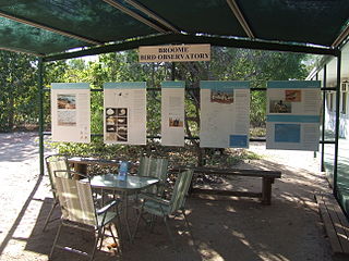 (t 08 9193 5600; open daily), on Roebuck Bay. The observatory
is on the site of one of the best non-breeding grounds for
migrant Arctic waders, as well as over 250 other species of
birds. More than 150,000 migratory birds from the Northern
hemisphere pass through Roebuck Bay and 800,000 birds use the
site annually, making this centre a prime location for
birdwatchers of all levels. The observatory is well organised
and can offer a variety of tours and camping facilities. It is
one of four in Australia; the others are Eyre in Western
Australia; Rotamah Island in Victoria; and Barren Grounds in
New South Wales.
(t 08 9193 5600; open daily), on Roebuck Bay. The observatory
is on the site of one of the best non-breeding grounds for
migrant Arctic waders, as well as over 250 other species of
birds. More than 150,000 migratory birds from the Northern
hemisphere pass through Roebuck Bay and 800,000 birds use the
site annually, making this centre a prime location for
birdwatchers of all levels. The observatory is well organised
and can offer a variety of tours and camping facilities. It is
one of four in Australia; the others are Eyre in Western
Australia; Rotamah Island in Victoria; and Barren Grounds in
New South Wales.Further along Highway 1 and near the Cape Levegue Road, 35km north of Broome, is Willie Creek Pearl Farm (t 08 9193 6000; open daily), an excellent facility housed in a lovely building, with informative demonstrations of pearl seeding. Cape Leveque, the point of which is some 200km north of Broome, is Aboriginal land. Relaxed and casual tours and cabin-style accommodation on the Lombardina Aboriginal Reserve can be arranged through Lombardina Tours in Broome (t 08 9192 4936) or by phoning Kooljaman Resort, t 08 9192 4970.
Derby
Situated on King Sound 220km northeast of Broome, Derby (population 3250) is the administrative centre for the western part of the Kimberley, and the base for many adventurous outback expeditions. Once extremely isolated, recent road improvements have made it accessible enough to support a good tourist industry. Its location on the edge of mirage-producing mud-flats and mangrove swamps made it unsuitable as a port, and contributes to a rather drab appearance. Still, the residents are friendly and, as J.K. Ewers wrote in With the Sun on My Back (1953), 'Whoever named Derby after an erstwhile Secretary of State for the Colonies either had no imagination or else conceived it as a prodigious joke...forget about the classic "Darby" and its English pronunciation, for here, ...it's "Derby".' The annual Boab Festival in July, named in honour of the town's many boab trees, features a rodeo and a famous mud-football competition, as well as cockroach races. Tourist information: 1 Clarendon Street; t 08 9191 1426.
Kuril Kuril painting
The Aboriginal community at Warmun (also known as Turkey Creek), 163km north of Halls Creek on the Great Northern Highway, have been painting Kuril Kuril (pronounced 'grill grill') paintings since the early 1970s. These are based on the palga narrative dance cycle related to Cyclone Tracy. The most famous of these artists, Rover Thomas (d. 1998), had a spirit dream from a female relative. She had died while being flown to hospital in Perth. In the dream she revealed to Thomas that she had been over the ocean whirlpool home of a Rainbow Serpent named Juntarkal; Thomas interpreted Cyclone Tracy as this creature, furious that the people had not kept the law. She also gave him a number of songs and dances commemorating her trip from the place of her death to that of her conception near Turkey Creek.
Initially, the Kuril Kuril paintings were for ceremonial use, but secular paintings were made in the early 1980s as a result of public interest in them and the introduction of canvas as a substitute for the wooden boards carried in the palga dances. Rover Thomas's fame rests on his broad areas of canvas in natural colour and the striking composition of his canvases. Rightly admired for his colour sense, he said of Mark Rothko upon seeing the New York artist's work, 'That white fella paint like me, but he don't understand black.'
The Warmun artists use a number of conventions from the Central Desert groups (the best known for Aboriginal paintings), but rather than depicting ancestral events, their works are maps of the landscape. They depict where ancestral events happened in order to be appropriate in secular settings. Rover Thomas's Cyclone Tracy (1991), on view at the National Gallery in Canberra, presents a stark depiction of the cyclone's black path.
Some of the Warmun community's works would be available at Waringarri Aboriginal Arts in Kununurra (t 08 9168 2212) and in the reputable dealers' galleries in the major cities.
To the south of Derby (7km) is the famous Boab Prison Tree, reputedly used as a cell to hold Aboriginal prisoners. In his Gifts Upon the Water (1978), Alec Choate includes the poem 'Prison Tree, Derby', which ends: 'Can it ever remind us/Of the alien heartbeats/That took the place of its heart?/For here was a prison cell./Here Man was a kept shadow...' Also near the Prison Tree is Myall's Bore, a huge cattle-trough, 120m long and 4.2m wide, used to water cattle in the old droving days.
The Pigeon Heritage Trail, the historic tour through town (brochure available from the tourist office), alludes to the nearby hideout of the Aboriginal outlaw Jandamarra, called Pigeon by the authorities, who was central to the stories of black-white hostilities here in the 1880s. The great adventure writer Ion Idriess relates Pigeon's escapades in his Outlaws of the Leopolds (1952), referring to the King Leopold Ranges to the east of Derby. A former police tracker, Pigeon, after killing several officers, went on a three-year spree of mayhem and murder. He was eventually tracked down by fellow trackers and killed in 1897.
Central Aboriginal Land
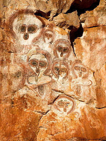 The regional Aboriginal
rock paintings centre around Wandjina spirits. Involved in the
creation myths, these wondrous fertility guardians bring the
monsoons and cyclones to ensure regeneration of life. They are
in human form with hair that is also the area's large, white
cumulonimbus clouds. They can cause lightning to emanate from
their feathered headdresses. The Wandjina live the dry months
of the year in their self-portrait rock paintings. During The
Wet, the local Aboriginal people preserve them by retouching
the paintings while the Wandjina are away tending to the
rains.
The regional Aboriginal
rock paintings centre around Wandjina spirits. Involved in the
creation myths, these wondrous fertility guardians bring the
monsoons and cyclones to ensure regeneration of life. They are
in human form with hair that is also the area's large, white
cumulonimbus clouds. They can cause lightning to emanate from
their feathered headdresses. The Wandjina live the dry months
of the year in their self-portrait rock paintings. During The
Wet, the local Aboriginal people preserve them by retouching
the paintings while the Wandjina are away tending to the
rains. The principal sites of the rock paintings are the Prince Regent Area, 250km northeast of Derby, and the Donkey Ridge Area, 190km southwest of Wyndham. Sites south of Kalumburu include the Derre Area, 125km south-southwest, the Paten Area, 40km southeast, and the Carson River Station Area, 23km southeast. Most of these sites can be visited, some requiring permission to travel on Aboriginal land. Check in Derby or Kununurra or Wyndham for more information.
Older paintings are known as Bradshaw figures after explorer Joseph Bradshaw who first reported them (1892). These are smaller, averaging about 30cm in height, in red or off-red ochre. Interesting compositions, they depict hunting and dancing scenes and are said to have been done by a bird which could see spirits invisible to humans. These figures seem similar to figures in Arnhem Land paintings. Josephine Flood, conservation officer at the Australian Heritage Commission, surmises that these paintings mark the westernmost extent of an earlier cultural group formerly prevalent across the northern section of the continent. Some of the best known of the Bradshaw figures appear in areas around the Kalumburu Aboriginal community, located on the King Edward River near the northern tip of the Kimberley, 313km from Gibb River at the end of the Derby Road. You will need a permit to visit the community, t 08 9161 4300) and provisions for camping. For more information on accessible rock art in the region, the Department of Parks and Wildlife offices are helpful (Broome, t 08 9195 5500).
The spectacular Devonian limestone gorges on the Fitzroy River at Giekie Gorge and on the Margaret River as it cuts through the Leopold Range near Fitzroy Crossing (population 1120) are popular attractions.
In addition to the geology, the area is recognised for the freshwater crocodiles, barramundi fish and red river eucalypts; and here you can spot numerous migratory and resident bird species in the lagoons and intertidal marshes around Derby and, particularly, Wyndham. The flora is generally eucalypt forest. The monsoonal forests are noted for deciduous trees which drop their leaves during the hot and arid winter. Among these, the baobab's curiously oval trunk can be used for storing water.
The Kimberley coast was the first area on the western edge of the continent to be charted, on this occasion by the Dutch merchant seaman Dirck Hartog in 1616. Unlike Hartog's, William Dampier's descriptions (1688) were not kept secret. Dampier was also the first to describe Aborigines. He found the people living in the King Sound to be 'the miserablest people in the world'. The Aborigines were equally mistaken, calling him 'Ngaarri' (rather than Dampier's transcription 'Gurri'), the name of a fickle and malevolent spirit being.
Alexander Forrest's 1879 description of the potential of the land for grazing led to early settlement. Noteworthy pastoralists included the Murray Squatting Co., which took nearly 50,000 ha in the east near Beagle Bay (Yeeda Station, 1881), and the Durack family (Ord River, 1885), who reached the western Kimberley area after a two-year-long cattle drive from southwestern Queensland. The rough hills and steep ravines and gorges of the King Leopold, Napier and Durack Ranges still separate these two areas. The writer Mary Durack spent her early childhood on the family company's stations in the eastern Kimberleys; she returned here with her sister in the 1930s and took charge of Ivanhoe Station. Durack's books, Kings in Grass Castles (1959) and Sons in the Saddle (1983), commemorate the pioneering families of this region. Her most famous book, Keep Him My Country (1955), portrays a typical Kimberley cattle station in the early days.
A short-lived gold rush brought some permanent settlers to Halls Creek (population 1265) in the 1880s. The inhospitable dry months and resistance from the Aboriginal population stalled the influx of settlers. After the Second World War an effort was made to encourage settlement around the Lake Argyle irrigation project on the Ord River. Nonetheless, Wyndham's cattle-processing facility closed in 1985. Tourist information: Great Northern Highway, t 08 9168 6262; call for open hours 7.00-17.00 June-Aug., maybe April-Oct also. From Halls Creek you have access to the Purnululu National Park in the Bungle Bungle Range, c 100km northeast, and the Wolf Creek Meteorite Crater, 150km south.
 The crater is the
second largest found, measuring nearly 1km wide and 50m deep.
The rock formations of the Bungle Bungle Range in the national
park are famed for their tiger-striped rocks and
beehive-shaped domes consisting of sandstone formations
encased in silica and lichen. Covering almost 320,000 ha, the
area conserves 110,000 ha as reserve and the rest is open as
national park. Picnic and camping grounds are well established
throughout the park, with some amenities; and walking trails
lead to the magnificent Cathedral Gorge and Echidna Chasm.
Scenic flights over the ranges can be arranged through the
tourist offices at Halls Creek or Kununurra.
The crater is the
second largest found, measuring nearly 1km wide and 50m deep.
The rock formations of the Bungle Bungle Range in the national
park are famed for their tiger-striped rocks and
beehive-shaped domes consisting of sandstone formations
encased in silica and lichen. Covering almost 320,000 ha, the
area conserves 110,000 ha as reserve and the rest is open as
national park. Picnic and camping grounds are well established
throughout the park, with some amenities; and walking trails
lead to the magnificent Cathedral Gorge and Echidna Chasm.
Scenic flights over the ranges can be arranged through the
tourist offices at Halls Creek or Kununurra. Please keep in mind that this region is rugged territory; BE PREPARED with provisions (water!) and expect rigorous walking and serious camping if you are staying. This park has not been 'touristised'. It is closed from January to April, that is, during 'The Wet'.
The Mirima (Hidden Valley) National Park, on Barringtonia Avenue in Kununurra (t 08 9168 4200), is referred to locally as 'the mini-Bungles', with similar beehive formations as at Purnululu. Pleasant walking trails and picnic grounds are worth exploring.
Speaking of the area between Halls Creek and Wyndham, Ray Erickson in West of Centre (1972) writes: 'The hills, grass-covered and tree-crowned, ranging in shape from long flat-tops to inverted pudding basins, are constantly engaging in form, but it is colour above all which distinguishes them. They bring to its climax the pervasive purple which strongly identifies this region.'
The drive from Kununurra to Wyndham, c 160km, passes through some spectacular gorges. The Five Rivers Lookout provides a view west across the region. Kununurra (population 4800) is 151km north of Warmun and is the hub of the eastern Kimberley region next to the Ord River Scheme. Tourist information: East Kimberley Tourism House, Coolibah Drive, t 08 9168 1177. It is also the centre of Australia's diamond-mining industry (particularly renowned for pink diamonds); the Argyle Diamond Mine, located southwest of town and accessible by tour only (through the tourist office), is the world's largest diamond mine, most of them industrial quality. Also south of Kununurra (72km) is Lake Argyle, Australia's largest artificial lake, measuring 980 sq km and containing 10 times as much water as Sydney Harbour. The lake now teems with birdlife and has good spots for swimming and fishing. Also here is the Argyle Homestead Museum (open daily 09.00-16.00 Apr.-Sept; admission adults $4.00, children $2.00), the structure built by pioneer Patsy Duracle in 1894; its original location was flooded when the lake was made, and so it was moved brick by brick to this location.
One More Time Please Note. When travelling through the Kimberley region, be sure to follow all precautions and advice for outback travel: carry water, refill your water at every chance, tell the authorities of your whereabouts, and be prepared for food and accommodation.
Illustration credits, nearly all from WikiCommons
800px-Central_Perth_from_Kings_Park.jpg - Dcoetzee
800px-Bluff_knoll_pana_01_gnangarra.jpg - Gnangarra...commons.wikimedia.org
750px-Cygnus_atratus,_Lake_Claremont.jpg - I, Cygnis insignis
783px-Improvement_to_Swan_River_Navigation_1830-1840.jpg - Battye Library [Map 2/5/19]
William Street Horseshoe Bridge.JPG - User:JarrahTree
120px-ForrestPlacePerth01_gobeirne -
800px-High_Street_Fremantle_2 - Marky
800px-Bunbury_old_port.jpg - SatuSuro
800px-Carnarvon_Jetty,_Western_Australia - Nachoman-au
Greatnorthernhwy2 - http://commons.wikimedia.org/wiki/File:Greatnorthernhwy2.png
360px-Western_Australia-climate-map.png - Australian Bureau of Meteorology
800px-Karijini6.jpg - Bäras
Wildflowers_western_australia.jpg - Raygday
Charles von Hügel
South_Perth_(WA)_From_Mount_Eliza - Bortzmeyer
Perth City Beach - Tintazul
800px-Cottesloe_Beach,_Perth,_Western_Australia_(4431664542) - Michael_Spencer
800px-Scarborough_Beach_Perth_WA - Cookaa
Sorrento Beach - Rhyshuw1 (talk)
Leighton Beach - https://www.youtube.com/watch?v=KVPmgwS2CY0
Wesley Church - Chewy m at English Wikipedia
Charles O'Connor - State Library of Western Australia
http://www.flickr.com/photos/bbmexplorer/6553262653/
Fremantle Arts Centre - Ghostieguide
Fremantle Markets - User:Gnangarra
Fremantle Maritime Museum - JarrahTree
Samson House - Tom Wilson, http://tmwilson.org/
Quokka - Gavin Williams
Woodbridge House - Evad37
Trail in John Forest National Prak - JarrahTree
Bibbulmun Track sign - Bjørn Christian Tørrissen
York town hall - ashul
Pinjarra Post Office - User:Moondyne
Wonnerup House - Gnangarra
Georgiana Molloy - Australian National Botanic Gardens
Distribution of karri forests - Hesperian
Esperance Municipal Museum - Orderinchaos
WA Gold Museum entrance - Bahnfrend
St Gertrude's New Norcia - Michal Lewi
Pinnacles Nambung - W. Bulach
Monkey Mia dolphins - Mark O'Neil, aka User:Digitaltribes
Burrup Rock Art - Tradimus
Karigini National Park, Joffre Gorge - Brian W. Schaller
Japanese gravestones - Adam.J.W.C.
Sun Pictures - Dan arndt
320px-Broome_Bird_Observatory.JPG - Neitram
Wandjina_at_mt_elizabeth.2.jpg - Robyn Jay
320px-Wolfe_creek_crater.jpg - de:Benutzer:Kookaburra